Encompassing 1.3 million km2, the Madeira Basin covers approximately 19 percent of the Amazon Basin. The Basin is larger in size than any Amazonian country except Brazil. The Madeira Basin is probably the most geographically complex tributary basin in the Amazon.

Map: Wildlife Conservation Society, 2016
The headwaters of the Madeira River arise in the southernmost Andes within the Amazon Basin, in the eastern Bolivian lowlands and on the Brazilian Shield. Except in the south, most of the Madeira Basin is within the lowland rainforest zone. Savanna predominates throughout the southern part of the Basin. The mouth of the Madeira River is approximately 1,300 km from the mouth of the Amazon River. The farthest headwaters of the Madeira rise near Cochabamba, Bolivia. They are approximately 3,300 km from the mouth of the Madeira and approximately 4,600 km from that of the Amazon River. The Madeira is the longest tributary in the Amazon Basin and accounts for approximately15 percent of the Amazon River’s total discharge to the Atlantic.
About 50 percent of the Madeira Basin is in Bolivia, 40 percent in Brazil and 10 percent in Peru. Brazil and Bolivia share a 1,000 km long border along the Mamoré and Guaporé-Iténez rivers. Within the three countries there are 14 administrative regions (called “states” in Brazil; “departments” in Bolivia and Peru) in the Madeira Basin. The largest cities in the Madeira Basin are La Paz (2 million in metropolitan area), Santa Cruz de la Sierra (2 million) and Cochabamba (1 million), all of which are in Bolivia and along small tributaries, and Porto Velho (500,000) on the Madeira River in Brazil.
We recommend reading “WCS Scientists Document World’s Largest Hatching of Baby Turtles”.
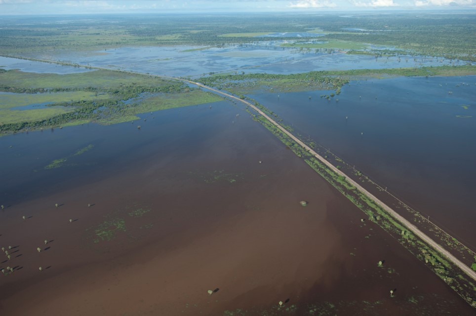
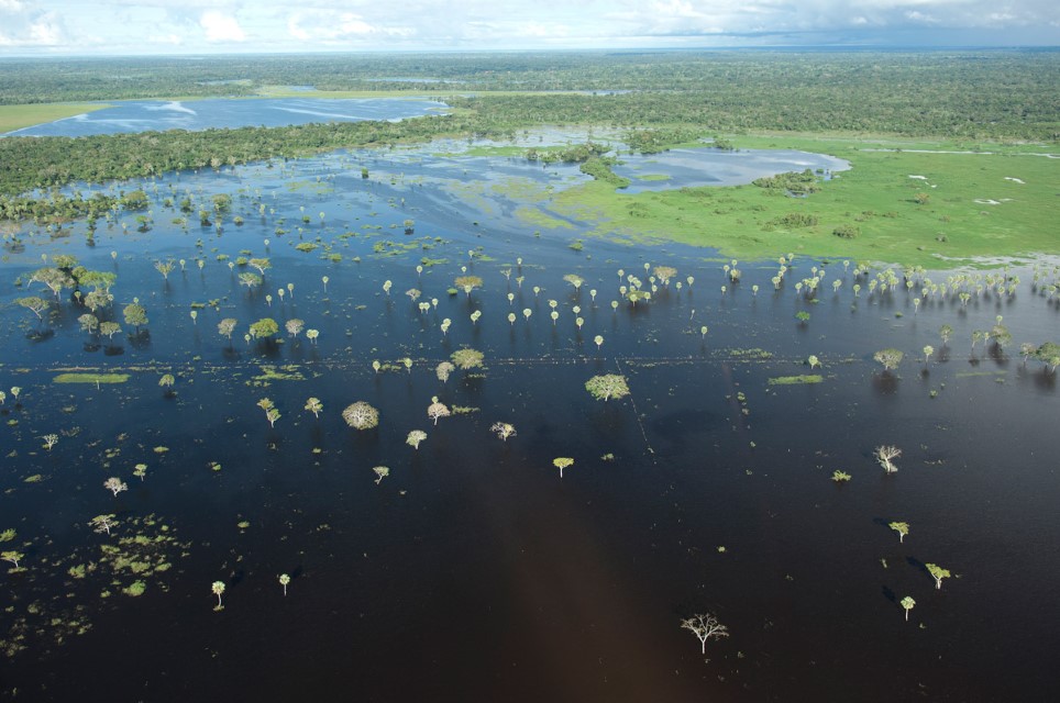
Wetlands cover an extensive area – at least 60,000 km2 within the Madeira Basin. The most extensive wetlands within the Madeira Basin are the floodable savannas of the Llanos de Mojos region in the center of the department of Beni in Bolivia. Occupying approximately 180,000 km2, the Llanos de Moxos wetlands are also the most extensive savanna wetlands in the Amazon Basin. Downriver of the Bolivian-Brazilian border, the Madeira River floodplain is relatively narrow, covering approximately 2,000 km2. A large part of the floodplain is blanketed with floodable forest that is inundated for four to six months each year.
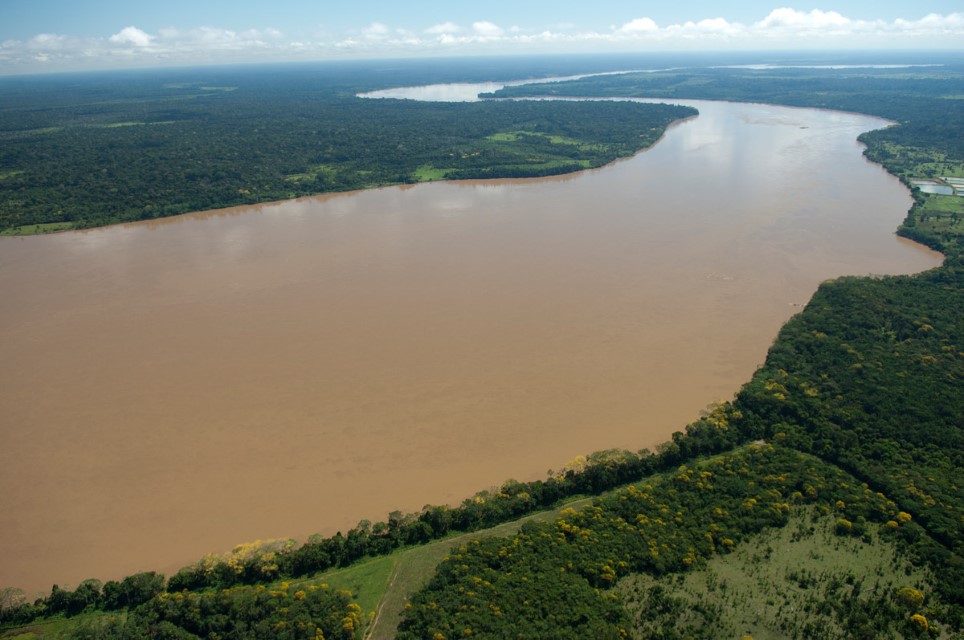
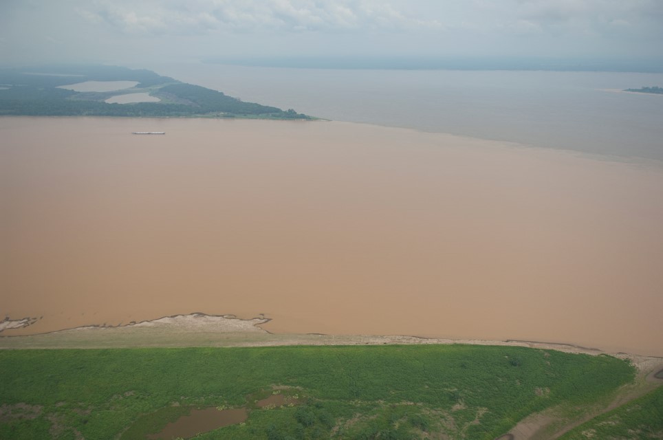
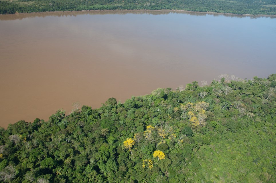
The Madeira is a highly turbid river and one of the two most important contributors of sediments to the Amazon River. Department – Country: Rondônia – Brazil Main Basin – Sub Basin: Madeira – Upper Madeira Main Stem Photographer: Luiz Claudio Marigo
Protected Areas
Superficially viewed the Madeira Basin appears relatively well protected because of a large number of various categories of conservation units and indigenous areas. Most, however, are still poorly managed and many are in the heavily deforested state of Rondônia in Brazil. There are large designated protected areas along the Guaporé-Iténez, but those in Brazil have been heavily invaded.
Bolivia’s largest wetlands in the Madeira Basin are the Llanos de Mojos but they are poorly protected. Bolivia’s most important designated protected area is Madidi National Park in the Beni drainage. Another large designated protected area in the upper Beni is the Isiboro-Secure National Park. Both Madidi and Isiboro-Secure parks have relatively large indigenous populations as well. The Manuripi-Heath National Park along the Madre de Dios is probably the most important protected area for eastern Bolivian wetlands because of its relatively sparse human population and the long stretch of the main river included within the park.
Manu National Park in the upper Madre de Dios watershed in Peru is the most highly publicized protected area in the Madeira Basin. Manu has probably received more media attention than all other protected areas in the Madeira Basin combined and it holds an exceptional combination of natural beauty, scientific interest, relatively pristine natural conditions and proximity to South America’s most visited tourist attraction – Machu Picchu in the Andes near Cuzco. The park occupies approximately 1,800 km2 and covers a wide range of terrestrial and aquatic habitats from lowland rivers to high Andean puna.
The second major designated protected area in the upper Madre de Dios region is in the Tambopata-Candamo and Heath Basins south of Puerto Maldonado, capital of the department of Madre de Dios in Peru. Protected areas include the Bahuaja-Sonene National Park and the Tambopata National Reserve. The area is rich in aquatic and terrestrial habitats, including wet savannas, floodplain forests, palm swamps and lowland and upland rainforest. Most of Tambopata-Candamo-Heath region is sparsely populated though gold mining has heavily impacted tributaries near the Andes. At the end of the 1990s Mobil extracted oil from an experimental well in the Tambopata-Candamo Basin but by 2000 the Peruvian government included this area within the limits of the Bahuaja-Sonene National Park and exploration ceased.
Uses & Impacts
The Cuiabá-Porto Velho highway, constructed in the early 1970s, connected central and southern Brazilian states with the western Amazon and allowed large-scale migration into the Madeira Basin, especially to the then Federal Territory of Rondônia, which became a state in 1981. Colonists originally settled mostly along the Cuiabá-Porto Velho highway, which cut across the divide between the Machado (Ji-Paraná) and Guaporé-Iténez Rivers. The highway was paved in the mid-1980s and numerous feeder roads branched into the Guaporé-Iténez Basin and north into the Machado (Ji-Paraná) Basin.
The Porto Velho-Manaus highway along the Madeira and Purus divide opened in the mid-1970s. The Trans-Amazonian Highway traverses all large tributary headwaters of the middle and lower Madeira. Finally, the Porto Velho–Guajará-Mirim highway replaced the Madeira-Mamoré railway, which had been used since the early 1900s to bypass the Madeira rapids. There are still no dependable roads connecting Brazil with Santa Cruz de la Sierra or La Paz in Bolivia.
The most extensively modified wetlands in the Amazon Basin at the time of the European Conquest in the sixteenth century were probably those that existed on the eastern Bolivian plains. Arawak Indians transformed the swampy savannas by constructing earthworks to provide dry ground for crops, dwellings and roads. Large earthen weirs were also constructed to trap and retain fish. The Llanos de Mojos landscape was so extensively modified that the raised fields, large settlement mounds and earthen causeways can be easily spotted from a plane. Scholars believe that the pre-Columbian population of the eastern Bolivian plains may have reached 350,000, a figure much higher than presently found in the region. Ironically, forest appears to have encroached after the European Conquest and decimation of the Indians, which suggests that much of the savanna may originally have been forested.
More than two-thirds of the state of Rondônia, Brazil has been moderately to heavily deforested in the past four decades. The agricultural frontier is still expanding in Rondônia and colonization is heavy in the Guaporé-Iténez Basin, where the state’s largest wetlands are found. The Guaporé-Iténez wetlands are shared between Brazil and Bolivia but most impacts are on the Brazilian side. In Bolivia, the major agricultural frontier centers on Santa Cruz de La Sierra in the Mamoré sub-basin. This area has now become an important food supplier for Bolivia.
Nearby is the Chapare region, also in the upper Mamoré Basin, and it is the second most extensive agricultural frontier in Amazonian headwaters of Bolivia. The Chapare is also a major coca-growing area for the production of cocaine. A road between La Paz and Rurrenabaque – a Bolivian city in the upper Beni Basin – has begun to spur agricultural colonization in the upper Beni Basin. Rurrenabaque has developed inexpensive ecotourism to attract people interested in river trips. The Beni River flows through a narrow and scenic gorge in the Cerros de Bala near Rurrenabaque. The Bala site alone is reported to represent approximately one-fifth of the hydroelectric potential of Bolivia though environmental groups strongly oppose the dam because it would flood part of Madidi National Park.
Rondônia was one of the principal gold-mining regions in the Amazon Basin in the 1980s and early 1990s. Gold miners concentrated their efforts in two areas: in the cataract stretch of the Madeira River between Porto Velho and the Bolivian border and in small right-bank tributaries of the same region. Hundreds of large dredges sucked bottom sediments and churned the streambed for gold. Gold mining in the Madeira Basin is now concentrated in the Madre de Dios Basin in southern Peru, especially in the Inambari Basin where it is largely uncontrolled and causing major environmental damage. Other nearby smaller basins, such as the Colorado basin, have also been heavily transformed by gold mining. A large area of the Amazonian foothill region in southern Peru now looks like a moonscape due to uncontrolled mining activities.
The first large dam in the Madeira Basin was Samuel Dam on the Jamari River, which is a clearwater right-bank tributary downriver of Porto Velho. Its reservoir is about 540 km2. Two large dams have recently been completed on the Madeira River just upriver of Porto Velho in the cataract area. The reservoirs of these “run-of-the-river” dams, however, are relatively small and less than about 350 km2. An experimental bypass fish canal has been constructed around Santo Antônio Dam, whereas a bypass for the Jirau Dam farther upstream is on hold until there is evidence migratory fish will use it. All three Madeira Basin countries have identified many potential dam sites, with the proposed Inambari Dam on the Inambari River in Peru being the largest for the Andean region.
Gallery
-
Madeira 1
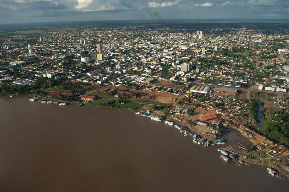
Porto Velho, Rondônia, Brazil and the Madeira River. Department – Country: Rondônia – Brazil Main Basin – Sub Basin: Madeira – Upper Madeira Main Stem Photographer: Luiz Claudio Marigo
-
Madeira 2
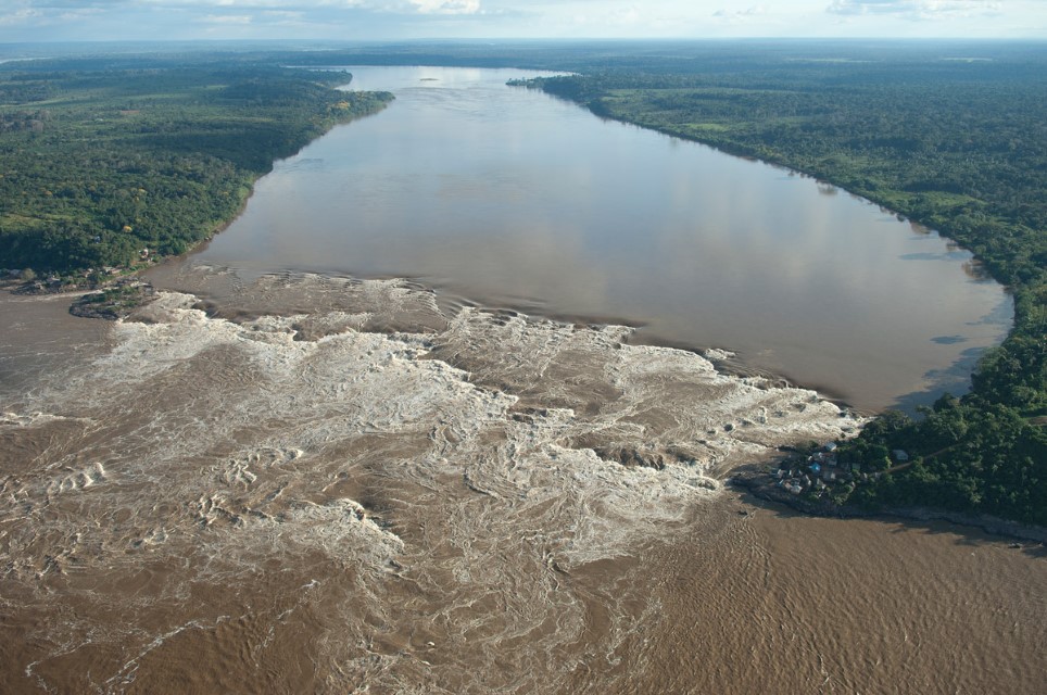
The Teotônio Rapids, historically the most formidable cataracts of the Madeira River. These Rapids are now completely submerged by the Santo Antônio Dam. Department – Country: Rondônia – Brazil Main Basin – Sub Basin: Madeira – Upper Madeira Main Stem Photographer: Luiz Claudio Marigo
-
Madeira 3
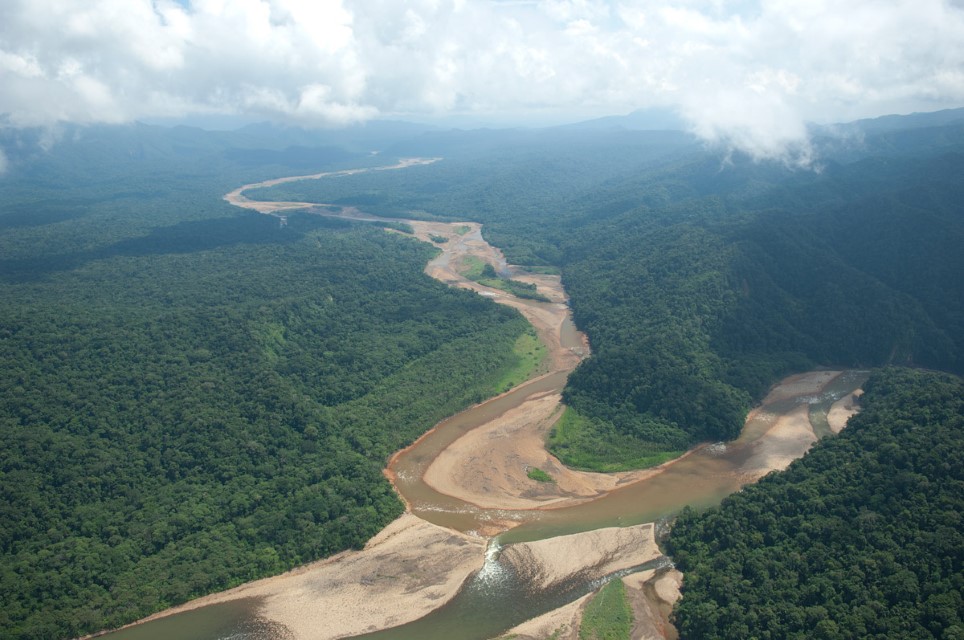
Headwater stream of the Madeira Basin in Bolivia near Santa Cruz de La Sierra. Department – Country: Santa Cruz – Bolivia Main Basin – Sub Basin: Madeira – Mamorecillo Photographer: Luiz Claudio Marigo
-
Madeira 4
Flooding in the Llanos de Moxos (Mojos) of the eastern Bolivian savannas. Department – Country: El Beni – Bolivia Main Basin – Sub Basin: Madeira – Mamoré Main Stem Photographer: Luiz Claudio Marigo
-
Madeira 5
Mixed forest and savanna wetlands of the Llanos de Moxos (Mojos) of Eastern Bolivia. Department – Country: El Beni – Bolivia Main Basin – Sub Basin: Madeira – Mamoré Main Stem Photographer: Luiz Claudio Marigo
-
Madeira 6
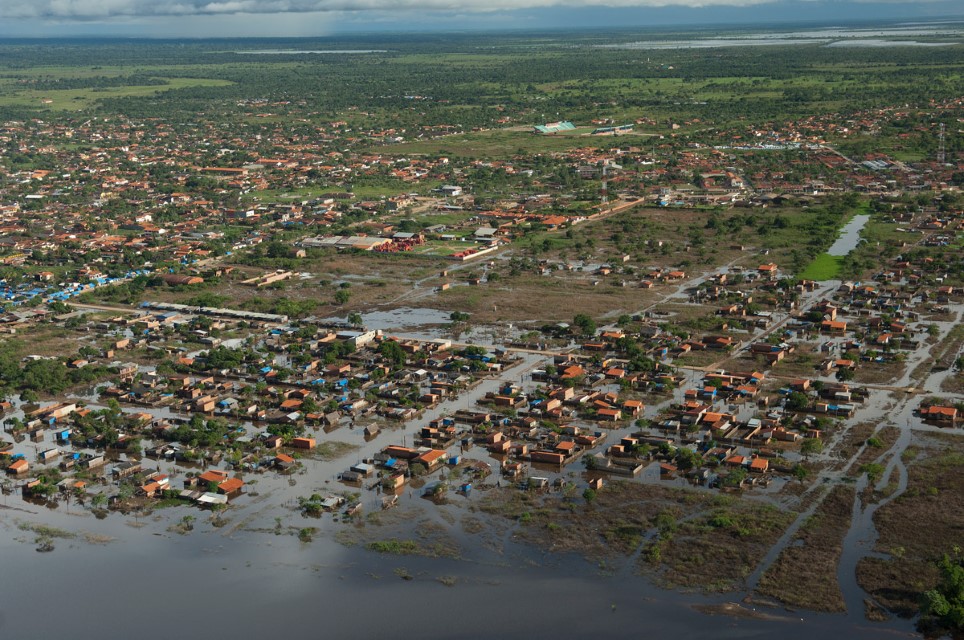
Urban flooding in the Llanos de Moxos (Mojos) of Eastern Bolivia. Department – Country: El Beni – Bolivia Main Basin – Sub Basin: Madeira – Mamoré Main Stem Photographer: Luiz Claudio Marigo
-

Madeira 7
Andean sediments discharged from the Andes in Bolivia near Santa Cruz de La Sierra. Department – Country: Santa Cruz – Bolivia Main Basin – Sub Basin: Madeira – Yapacani Photographer: Luiz Claudio Marigo
-
Madeira 08
Meeting of the Madeira and Amazon rivers. Department – Country: Amazonas – Brazil Main Basin – Sub Basin: Amazon Main Stem – Eastern Amazon Main Stem Photographer: Luiz Claudio Marigo
-
Madeira 9
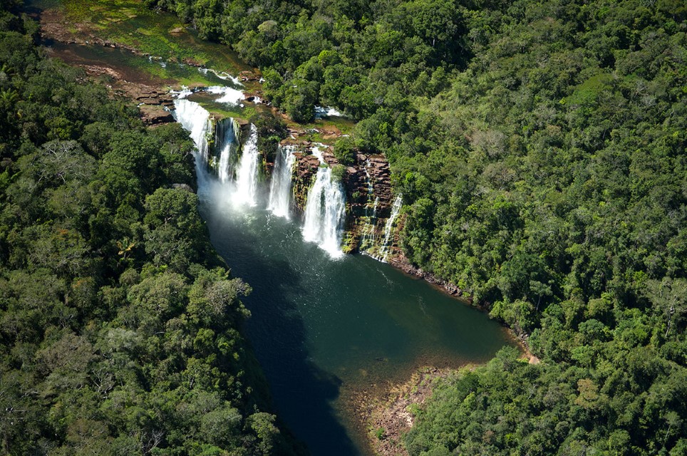
Waterfall of the clearwater Roosevelt River in Mato Grosso. Department – Country: Mato Grosso – Brazil Main Basin – Sub Basin: Madeira – Roosevelt Photographer: Luiz Claudio Marigo
-
Madeira 10
Department – Country: Rondônia – Brazil Main Basin – Sub Basin: Madeira – Upper Madeira Main Stem Photographer: Luiz Claudio Marigo
MAIN RIVER BASINS
Caquetá-Japurá
Juruá
Madeira
Marañón
Napo
Negro
Purus
Putumayo-Içá
Tapajós
Tocantins
Trombetas
Ucayali
Xingu

