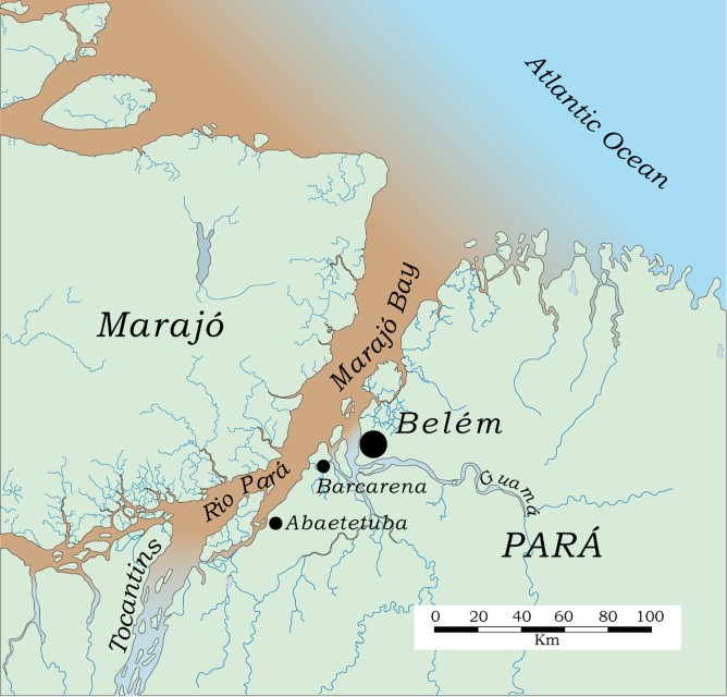
Covering approximately 4,500 km2, Marajó Bay is ecologically a part of the Amazon Basin, because of the Amazon River’s water discharge of water into the bay. Marajó Bay is bordered on the west by the island of Marajó and on the east by the mainland. Numerous peninsulas and islands characterize the eastern coastal area near the mouth of the Bay. Mangroves dominate the coastal vegetation and the littoral aquatic fauna is largely oceanic. Fresh water, however, does penetrate eastward along the mainland northeast of Marajó Bay during the high-water period (May–July) of the Amazon River. Small coastal rivers also contribute freshwater locally.

Source: Goulding, M., R.B. Barthem, E.J.G. Ferreira e R. Duenas. 2003. The Smithsonian Atlas of the Amazon. Washington: Smithsonian Books.
Its southern limit is usually taken to be near Belém where the Guamá meets the Pará. After shipping and cargo, Marajó Bay’s main commercial value is fishing. Experimental drilling for petroleum in Marajó Bay has not revealed economically viable deposits of fossil fuels.
Compared with the Amazon River, Marajó Bay discharges relatively little water and sediments. Nevertheless, Marajó Bay waters are always turbid because it receives large quantities of sediments from the Amazon River via the Breves Channel and the Pará River. Only a small percentage of Amazon River water flows through the Breves Channel, but this discharge is sufficient to muddy Marajó Bay throughout the year. Heavy deforestation in the state of Pará has also increased erosion in the Guamá Basin, which may increase the sediment input into Marajó Bay.
The deepest waters of Marajó Bay are less than 30 m deep. River discharge through Marajó Bay is sufficient to ensure a largely freshwater environment. During the low-water period of the Amazon River, however, the water becomes brackish for approximately 80 km inland from the Atlantic. Near Belém salt concentrations are less than approximately 1 ppt (oceanic water averages 35 ppt). Brackish water causes sediments to flocculate, that is, bind together and become heavier, which causes them to settle to the bottom. Water transparency is improved and phytoplankton production increases. Both freshwater and marine species of fish and shrimp use the phytoplankton-rich waters of Marajó Bay as nurseries.
The mainland coastal vegetation of Marajó Bay subject to tidal flooding ranges from mangroves near the Atlantic to freshwater forests farther inland. Occasionally mangrove species are found just beyond Belém, but they are not dominant. Mangrove species so far inland usually appear on new sandbars or mud flats that will eventually be overtaken by freshwater shrub and tree species.
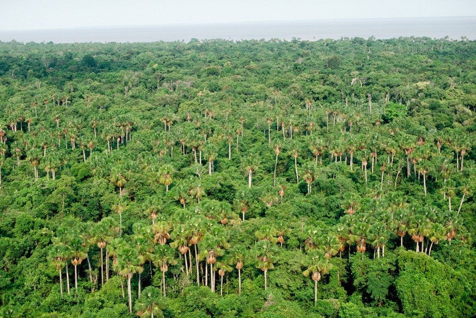
The tidal forests southwest of Belém are an excellent example of the eastern Amazon’s richness in palms. Buriti and açaí palms dominate. The açaí palm is exploited for palm hearts and fruit used in juices and ice creams. Local communities have managed the palm-dominated tidal forests relatively well. They leave most of the native forest intact but plant açaí, which can be harvested. Few floodplain communities in the Amazon have managed their flooded forests as well as these communities have in the estuarine region.
Although the mainland of Marajó Bay, with Belém in the center, is heavily populated, the natural tidal zone is still relatively intact. Some mangroves were killed when roads without culverts were built across them. However, these tidal forests have not been extensively cleared for crop or shrimp farming. There have been some rice- and pasture-farming experiments in the relatively rich soils of some tidal areas. Large-scale farming could one day threaten these habitats. The benefits of any large-scale farming projects in tidal forest areas should be weighed against their impacts on fisheries.
Marajó Bay is polluted to some extent by industrial and urban effluents from Belém and smaller coastal cities. The largest industrial facility on Marajó Bay is an aluminum-processing plant located on the island of Barcarena southwest of Belém. However, the Barcarena plant is modern, so slurry and tailings appear to collect in holding ponds.
-
MapsCharts_000453_en
-
MichaelGoulding_HiRes_000863
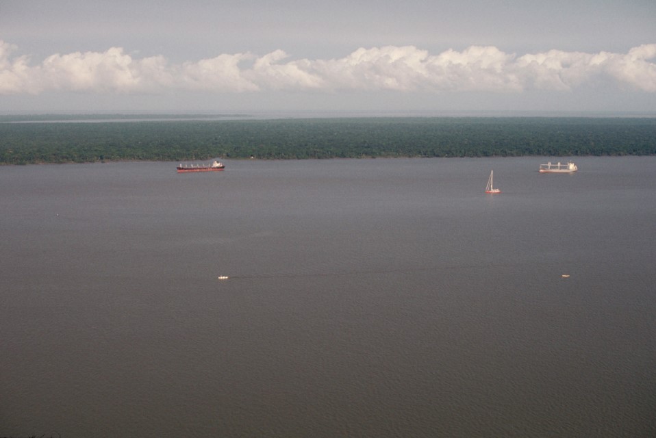
Amazon estuary near Belem with tidal forest in the background. Department – Country: Pará – Brazil Main Basin – Sub Basin: Amazon Main Stem – Eastern Amazon Main Stem Photographer: Michael Goulding
-
MichaelGoulding_HiRes_000927
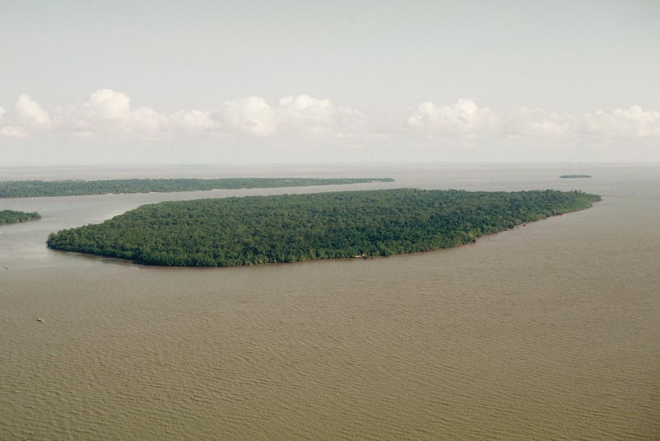
Tidal forest island of the Amazon estuary near Belem. Department – Country: Pará – Brazil Main Basin – Sub Basin: Estuary – South Amazon Estuary Photographer: Michael Goulding
-
MichaelGoulding_HiRes_0003711-1
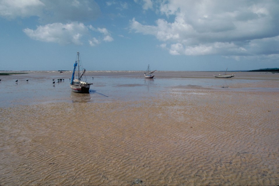
The estuary near where Marajó Bay meets the Atlantic. During the Amazon River’s high water period freshwater extends out of Marajó Bay and along the Atlantic coast. Department – Country: Pará – Brazil Main Basin – Sub Basin: Estuary – South Amazon Estuary Elevation: 19 Photographer: Michael Goulding
-
MichaelGoulding_HiRes_004571
Department – Country: Pará – Brazil Main Basin – Sub Basin: Estuary – South Amazon Estuary Photographer: Michael Goulding

