The Negro Basin covers approximately 716,000 km2, an area larger than the size of France. The Negro Basin encompasses 10.4 percent of the Amazon drainage and is the third largest sub-basin. The Negro River is approximately 2,500 km long and its Colombian headwaters are nearly 3,700 km from the Amazon River mouth.

Map: Wildlife Conservation Society, 2016.
More than 90 percent of the Negro Basin is in Brazil; the rest lies mostly in Venezuela and Colombia, with less than 1 percent in neighboring Guyana. Most of the Negro basin in Brazil lies in the states of Amazonas and Roraima; in Colombia it lies in the departments of Vaupés and Guainía; and in Venezuela in the federal territory of Amazonas. The Ministerial District Number 6 of Guyana has a small headwater area of the Negro Basin in the upper Branco drainage.
The Negro drains three principal regions: the northern tributaries of the river arise mostly on the southern Guiana Shield in Brazil; the northwestern headwaters arise in the Andean foothills of Colombia; and most of the right-bank tributaries arise in the lowlands below 200 m.
Pico de Neblina, Brazil’s highest mountain, rises to 3,014 m on the far western part of the Guiana Shield. The mountainous divide separating the Orinoco and Negro Basins ranges from 2,000–2,700 m in elevation. The principal mountain ranges of the divide are the Serra Pacaraima and the Serra Parima.
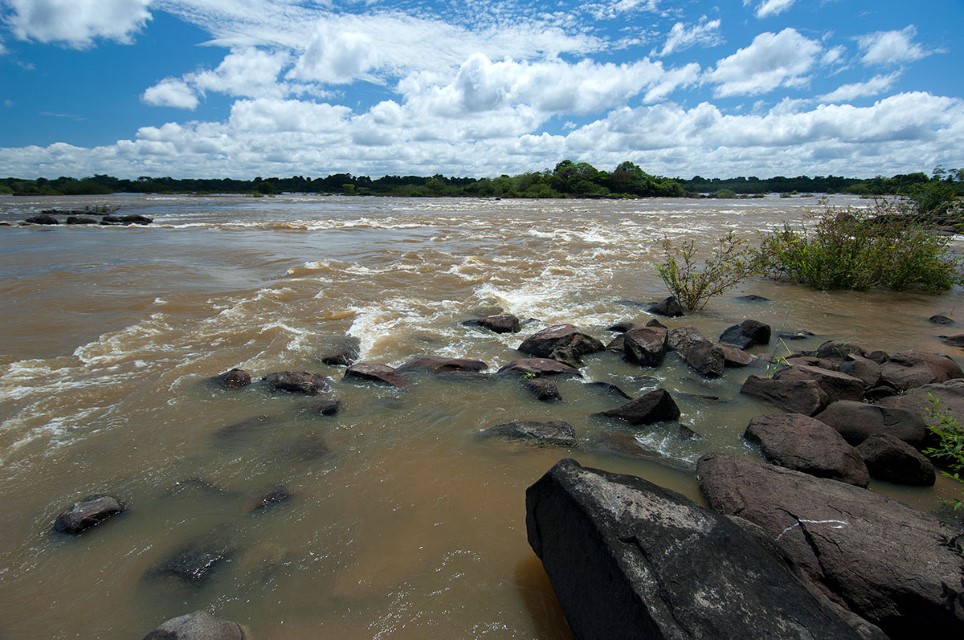
The ancient Guiana Shield is characterized by its numerous sandstone tablelands and isolated granite hills. The Negro’s largest tributary, the Branco, drains a large part of the southern Guiana Shield. Most Guiana Shield tributaries have numerous cataracts in their upper sections.
The Casiquiare Channel links the upper Negro River to the Orinoco River in Venezuela. The Negro River is formed after the confluence of the Guainía River and Casiquiare Channel (“Canal Casiquiare” in Spanish) in Venezuela. Headwater erosion in this region has partly diverted water flow in the Casiquiare Channel southwestward to the Negro. The Negro’s principal tributary in Colombia is the Vaupés, which is called the Uaupés after it enters Brazil. Several of the Negro’s western tributaries in Brazil, such as the Urubaxi, arise near the confluence of the Japurá and Amazon (Solimões) rivers. During the rainy season small streams connect the Negro and Japurá Basins. Far northwestern headwaters of the Negro arise in foothills near the Andes at less than 300 m.
The most striking characteristic of the Negro River is its black water. It is the only large blackwater river in the Amazon Basin, accounting for approximately 13–14 percent of the total annual discharge of the Amazon River. The Branco, the Negro’s largest tributary, is an exception (Branco literally means “White”). Although not as turbid as the Amazon River or the Madeira, the Branco has considerably higher sediment content than that of the Negro that renders it semi-turbid.
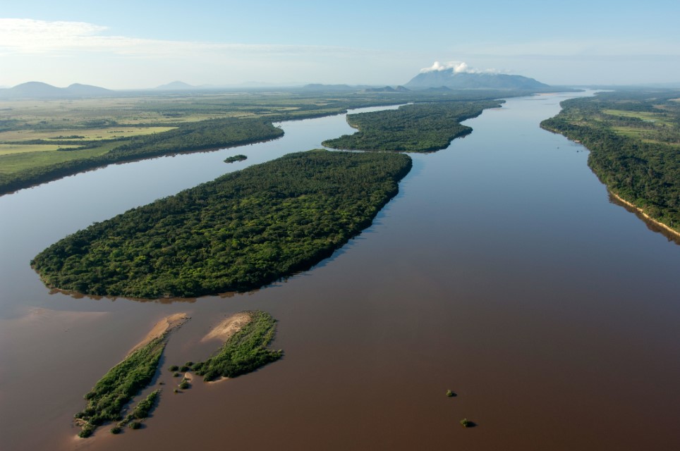
Branco River in savanna region of Roraima. Department – Country: Roraima – Brazil Main Basin – Sub Basin: Negro -Branco Main Stem Photographer: Luiz Claudio Marigo
The northwestern region can receive more than 3,000 mm of precipitation with the most rain falling from April through July. Northern Roraima gets the least amount of rain, where annual totals can be less than 1,600 mm. Approximately 2,200 mm of rain falls yearly in the lower Negro region. The main floods of the upper and middle Negro are between May and September. Water levels are usually highest in July and lowest from December through February. Water levels in the lower Negro up to approximately its confluence with the Branco River are controlled by the backwater effect of Amazon River.
In contrast to the upper and middle Negro, the lower Negro is in flood from February through July and the flood peak is usually reached in June; the lowest water months are September to December. Water levels in the middle and upper Negro are falling between December and February, whereas they are rising at that time in the lower river. The average annual river-level fluctuation of the middle and upper Negro ranges approximately 4–5 m, whereas near the mouth—where measurements have been taken since 1902—it is 10 m.
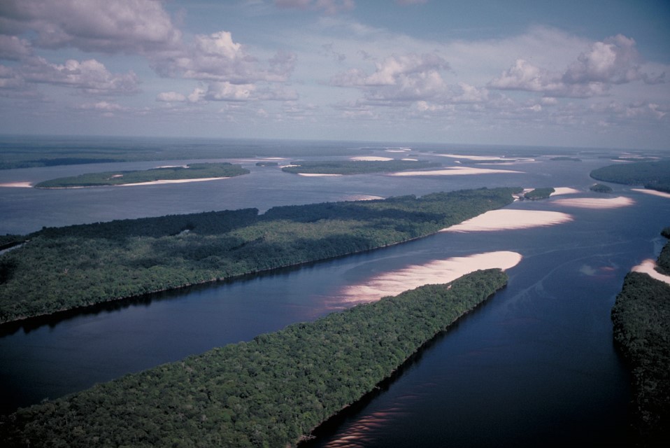
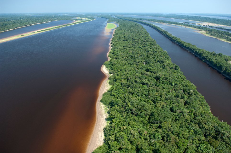
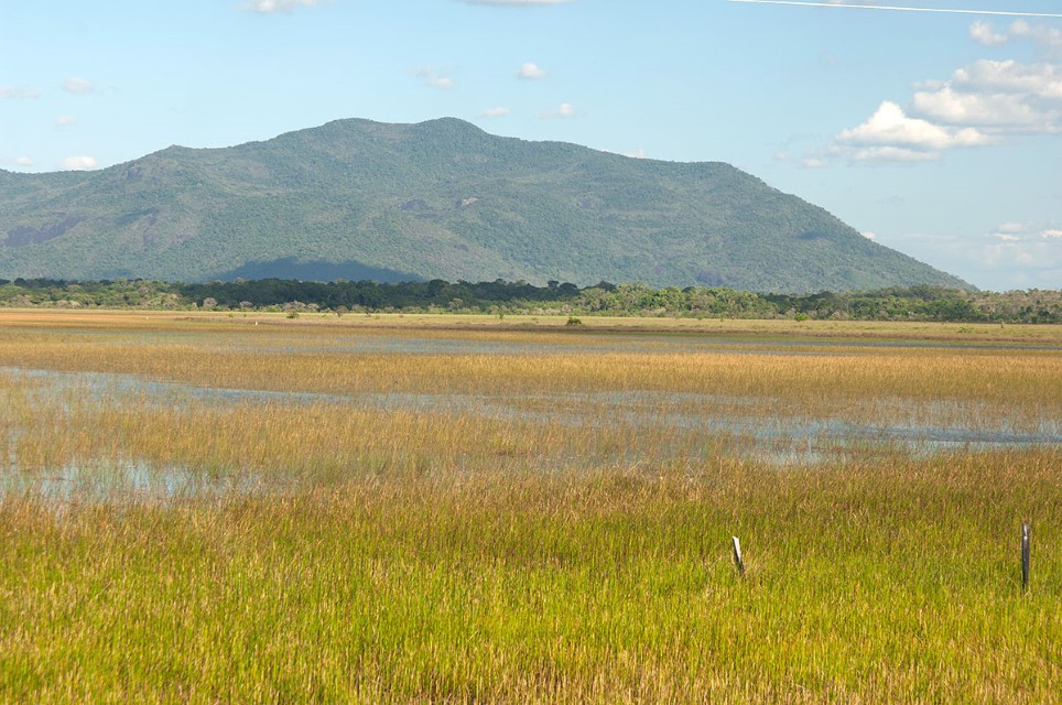
The Negro Basin covers an estimated 30,000 km2 that are subject to seasonal inundation, but the actual value is probably higher. The two largest areas that are seasonally inundated are the savannas in Roraima near Boa Vista and the enormous low-lying area north of the Negro between the Branco and Padauari Rivers. Dwarfed forest and palm swamps grow in much of the latter area, which is very sandy and stays flooded for about six months each year. The largest floodplains in the Negro Basin are those along the right-bank tributaries. Two large archipelagoes, with more than 1,000 islands among them, exist in the lower and middle sections of the river. Almost all of the islands are completely inundated during the floods. Forests that are inundated for four to eight months per year dominate most of the floodplain area within the Negro Basin.
Protected Areas
Large parts of the areas designated for protection in the Negro Basin are made up of land belonging to Brazilian indigenous groups and national park land. The Yanomami occupy most of the headwater region of the northern tributaries of the Negro along the southern Guiana Shield. Various other indigenous groups live in the large northwestern upper Negro region in Brazil, Colombia and Venezuela.
The largest national park in the Brazilian Amazon is Jaú National Park, which encompasses 22,700 km2. Only fishermen who sell ornamental fish are allowed to fish in the rivers within the park; other commercial fishing is strictly prohibited.
The Pico de Neblina National Park includes isolated headwaters of the Guiana Shield and also Pico de Neblina, Brazil’s highest mountain. The Anavilhanas National Park is located in the lower Negro region and includes nearly 350 islands, which are mostly covered with flooded forests subjected to six to seven months of annual flooding. Another important state protected area is the Maracá Ecological Station, in Roraima, along the Uraricoeira, the largest tributary of the Branco River.
Uses & Impacts
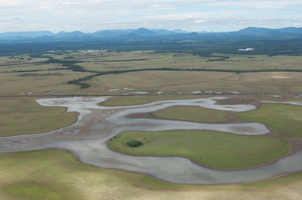
Heavily modified wetlands in the Roraima savannas. Department – Country: Amazonas – Brazil Main Basin – Sub Basin: Negro – Branco Main Stem Photographer: Luiz Claudio Marigo
With the exception of the Manaus area, the most extensively colonized area in the Negro Basin is in the Brazilian state of Roraima. The city of Boa Vista has become the hub of this area and its extensive road network connects it to Venezuela and Guyana internationally and to Manaus nationally. The transportation network has spurred large-scale colonization and deforestation increased greatly in the 1990s and 2000s. An intense and hot dry season, along with extensive savannas, makes the task of controlling and extinguishing fires all but impossible. It is estimated that about one-third of the area of Roraima has been burned. Fires set in the savannas quickly spread to forested areas, which can burn easily because of the relatively dry rainforest growing throughout much of Roraima.
Most deforestation in Roraima has been for cattle ranching though crop farming is expanding rapidly, both in the uplands and on the floodplains. The rich soils of some of the upper valleys are also attracting crop farmers. Rice is the principal crop grown on floodplains, whereas rice, maize, manioc and soybeans dominate upland farming. Riparian forests between the Branco River and the savannas have largely been cut in areas where rice is grown. Deforestation in Roraima appears to have led to increased erosion, which has increased sediment content not only in the Branco but also in the lower Negro River.
The floodplains along the Negro and Branco Rivers have been extensively logged for a few species. Loggers have also cut most of the large kapok trees (Ceiba pentrandra) along the Branco River. Upland logging is concentrated near urban centers. Gold miners have often invaded the Negro Basin but most gold mining now is done on or near Yanomami lands in Roraima, although some spills over into Venezuela.
The main extractive economic activities within the blackwater areas of the Negro Basin center on aquarium, sport and food-fish fisheries. Ecotourism has increased in the lower Negro River though its potential is far from realized. The Manaus Free Trade (Zona Franca de Manaus) dominates the economy of the Negro Basin’s largest city and the industrial complex it supports as well as urban effluents pollute not only the Negro along its left bank but also the Amazon River near their confluence. The confluence is an important spawning zone for migratory fish but impacts from pollution and river traffic are unknown.
Sport fishing for tucunaré has expanded throughout the Negro basin and, in some areas, has caused conflicts with local residents.
-
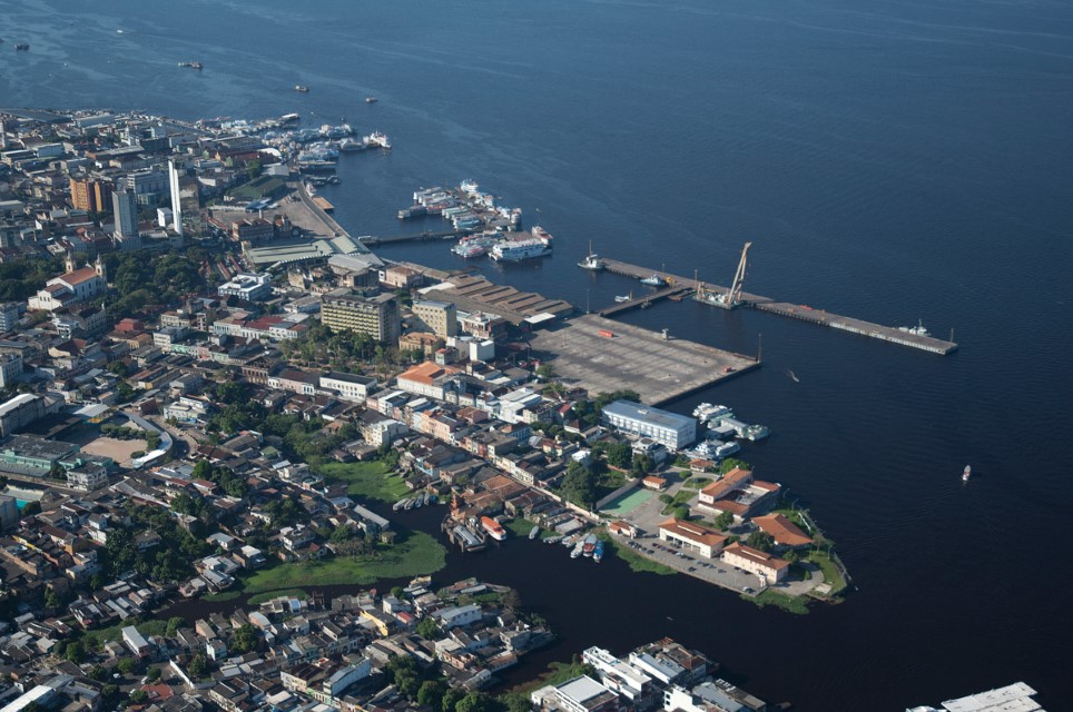
Negro 01
Manaus waterfront on the Negro River. Department – Country: Amazonas – Brazil Main Basin – Sub Basin: Negro – Lower Negro Main Stem Photographer: Luiz Claudio Marigo
-
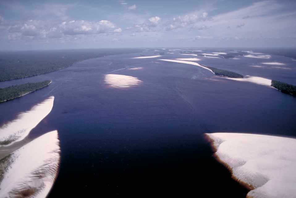
Negro 02
Middle Negro River upstream of Barcelos during the low water season with emerged white sand beaches. Department – Country: Amazonas – Brazil Main Basin – Sub Basin: Negro – Negro Main Stem Photographer: Michael Goulding
-
Negro 03
The Negro River has hundreds of islands that greatly increases its amount of shoreline and wetlands. Department – Country: Amazonas – Brazil Main Basin – Sub Basin: Negro – Negro Main Stem Photographer: Michael Goulding
-
Negro 04
The Anavilhanas Archipelago of the lower Rio Negro. Department – Country: Amazonas – Brazil Main Basin – Sub Basin: Negro – Lower Negro Main Stem Photographer: Luiz Claudio Marigo
-
Negro 06
Savanna wetlands in Roraima are largely inundated by local precipitation and not overflow from rivers. Department – Country: Roraima – Brazil Main Basin – Sub Basin: Negro – Branco Main Stem Photographer: Luiz Claudio Marigo
-
Negro 07
The Branco River at the Cachoeira Bem Querer, a potential site for a large dam. Department – Country: Roraima – Brazil Main Basin – Sub Basin: Negro – Branco Main Stem Photographer: Luiz Claudio Marigo
-
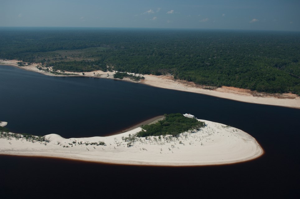
Negro 09
Department – Country: Amazonas – Brazil Main Basin – Sub Basin: Negro – Lower Negro Main Stem Photographer: Luiz Claudio Marigo
-
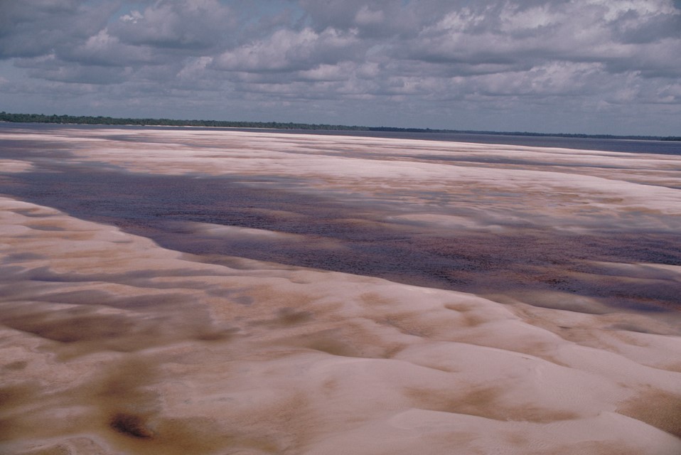
Negro 10
Department – Country: Amazonas – Brazil Main Basin – Sub Basin: Negro – Negro Main Stem Photographer: Michael Goulding
-
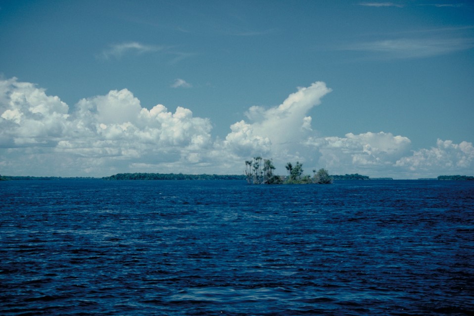
Negro 11
Department – Country: Amazonas – Brazil Main Basin – Sub Basin: Negro – Negro Main Stem Photographer: Michael Goulding
-
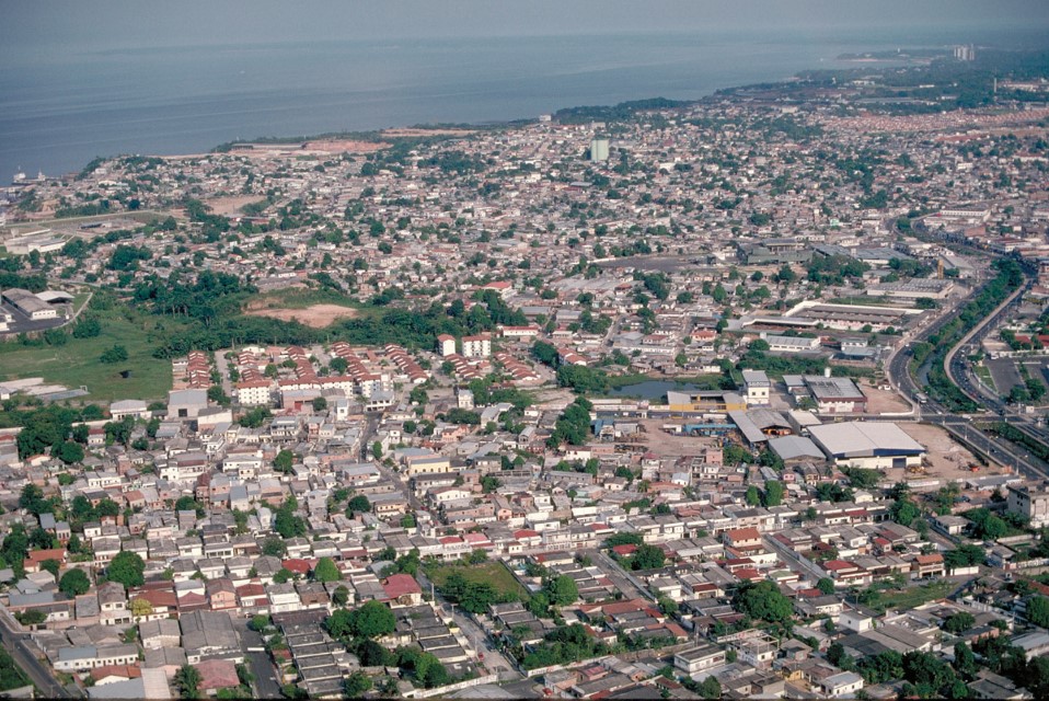
Negro 12
Belém near the upstream entrance of Marajo Bay. Department – Country: Amazonas – Brazil Main Basin – Sub Basin: Negro – Lower Negro Main Stem Photographer: Michael Goulding
-
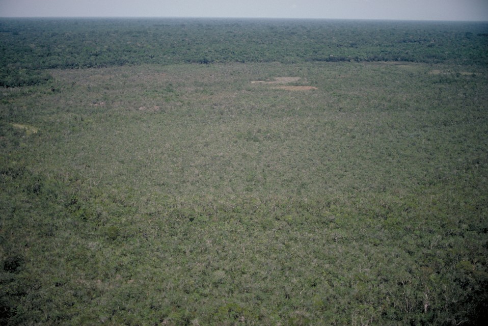
Negro 13
Department – Country: Amazonas – Brazil Main Basin – Sub Basin: Negro – Negro Main Stem Photographer: Michael Goulding
-
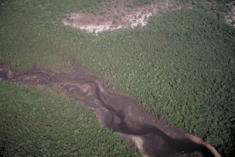
Negro 14
Department – Country: Amazonas – Brazil Main Basin – Sub Basin: Negro – Negro Main Stem Photographer: Michael Goulding
-
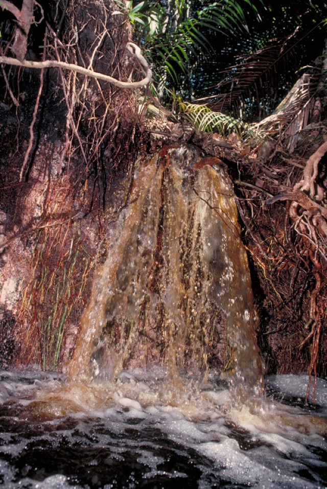
Negro 15
Department – Country: Amazonas – Brazil Main Basin – Sub Basin: Negro – Negro Main Stem Photographer: Michael Goulding
Follow us on social media for scientific outreach content about rivers and aquatic ecosystems in the Amazon: Twitter, LinkedIn and Facebook.
MAIN RIVER BASINS
Caquetá-Japurá
Juruá
Madeira
Marañón
Napo
Negro
Purus
Putumayo-Içá
Tapajós
Tocantins
Trombetas
Ucayali
Xingu

