The Juruá basin (217,000 km²) is relatively narrow in its middle and lower sections, with more than 90% located within the Brazilian states of Amazonas and Acre.

Map: Wildlife Conservation Society, 2016
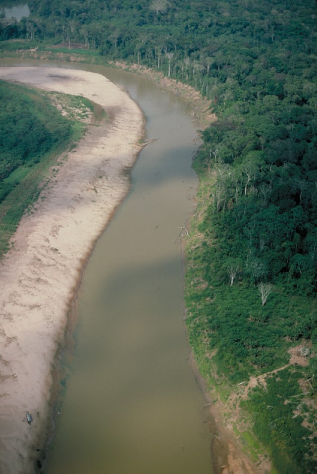
The Juruá River has numerous meanders, large floodplains, and thousands of lakes. The headwaters of the Juruá basin arise in the Ucayali department in Peru. The Juruá River is approximately 3,200 km long and has about 28,000 km² of wetlands. The headwaters of the Juruá River are at a higher elevation than those of the Purús and are located in the Sierra del Divisor, as it is called in Brazil, or the Sierra de Contamana, as it is called in Peru (adjacent to the east of the Sierra de Contamana). In Peru, there is also an area known as Sierra del Divisor, which is not the same as the one referred to in Brazil. The highest peak in the basin reaches approximately 878 meters above sea level. The water of the Juruá River represents about 2% of the annual discharge of the Amazon River.
Like the Purus River, the water of the Juruá is murky and has relatively high nutrient levels. Annual precipitation in the Juruá basin generally ranges from 1,800 to 2,200 mm, and annual fluctuations in river levels in the middle basin range from 12 to 15 m. The Juruá floodplains are inundated between December and mid-May. In its lower course, flooding can last until August due to the “dam” effect exerted by the Solimões River (Amazon River).
Protected Areas
The Juruá basin has relatively large protected areas in its headwaters and lower course. Additionally, indigenous areas have been recognized within it, making it the most protected major sub-basin in the Amazon. The Serra do Divisor National Park in Brazil occupies approximately 85,000 km² in the upper Juruá basin. Currently, this park is relatively isolated, although some dirt roads are expanding toward the park’s boundaries both from the west, through the main road of Acre and Cruzeiro do Sul, and from the south. This expansion is causing nearby areas to be exposed to logging and livestock activities. On the Peruvian side, the Sierra del Divisor National Park was recently established. The waters of this region drain into the Ucayali River. The proposed Pucallpa-Cruzeiro do Sul road would cross the park, creating many challenges for its management.
Uses and Impacts
Currently, deforestation in Acre, as a result of cattle ranching and logging, is the main threat to the management of the basin. If the road project from Cruzeiro do Sul to Pucallpa materializes, it will undoubtedly increase deforestation and likely lead to urbanization around the city of Cruzeiro do Sul. There is no significant mining activity in the Juruá basin, and commercial fishing occurs in most of the Juruá River, from approximately Cruzeiro do Sul to its mouth.
We recommend listening to the Podcast Voces do Juruá (Voices of Juruá).
-

Juruá 1
The Upper Juruá in Cruzeiro do Sul in Acre, Brazil. Department – Country: Acre – Brazil Basin: Juruá – Juruá Photographer: Michael Goulding
-

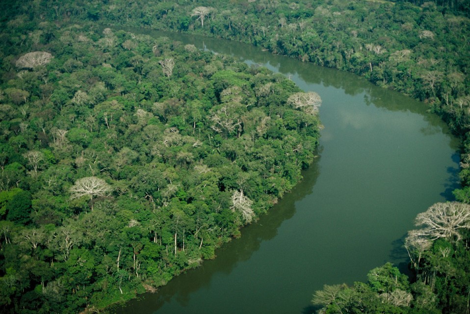
Juruá 2
Riverside forest on the Juruá River in Acre, Brazil. Department – Country: Acre – Brazil Basin: Juruá – Juruá Photographer: Michael Goulding
MAIN RIVER BASINS
Caquetá-Japurá
Juruá
Madeira
Marañón
Napo
Negro
Purus
Putumayo-Içá
Tapajós
Tocantins
Trombetas
Ucayali
Xingu

