

Clearwater rivers are characterized by crystalline waters, like rainwater, with very low turbidity and little to no color, owing to minimal sediment transport and very low concentrations of dissolved substances. In the Amazon Basin, some tributaries that originate in the Amazon lowlands, approximately below 300 m elevation, i.e., in the middle and lower basin, are clearwater.
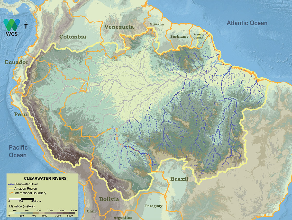
Map of the clear water rivers of the Amazon Basin. Clearwater rivers transport relatively little sediment and arise mostly on the ancient Brazilian and Guiana Shields. Map: Wildlife Conservation Society, 2016.
On a geological scale, the Brazilian and Guiana Shield represent ancient, deeply eroded surfaces with highly compacted materials that yield little sediment to rainfall or river transport.
The color of clear waters
Compared with whitewater rivers, all clearwater rivers and streams of the Amazon Basin have minimal suspended sediment concentrations.
Given the minimal amount of sediment they carry, the chemistry of lowland clearwater streams is often very similar to that of distilled water, with minimal concentrations of any dissolved minerals or salts. Generally, concentrations of major nutrients are low, and sodium tends to be the dominant ion. Most clearwater rivers and streams in the central and eastern Amazon Basin are slightly acidic, with pH values ranging between approximately 6.0 and 6.8, though these can be higher in the western tributaries in or near the Andes.
A surprising fact is that the average sediment concentration per volume of water in the Tapajós can be as low as 1% of that in the Amazon River into which it flows. Another interesting fact is that rainforest streams often have even lower sodium concentrations than rainwater, indicating how efficient the tropical rainforest is at retaining nutrients.
-
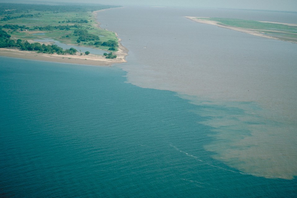
Aguas Claras 1
The confluence of the clearwater Tapajós River and the Amazon River near Santarém. Department – Country: Pará – Brazil Main Basin – Sub Basin: Amazon Main Stem – Eastern Amazon Main Stem Elevation: 32 Photographer: Michael Goulding
-
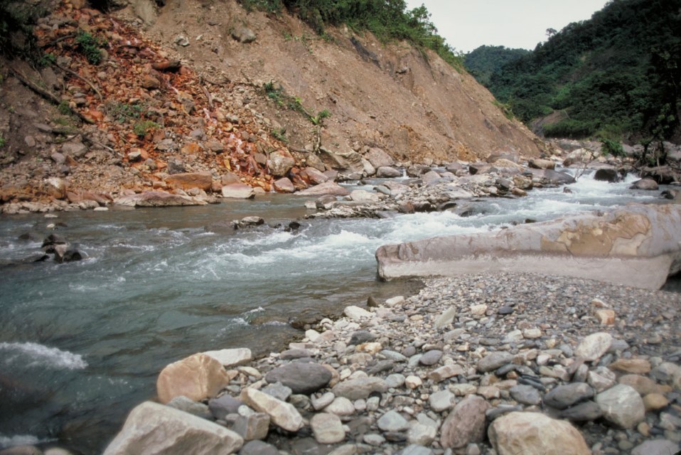
Aguas Claras 3
Andean small river that runs fairly clear when not raining locally. During storms, however, the loose material along its banks is eroded and its waters become highly tubid until the rains stop. Department – Country: La Paz – Bolivia Main Basin – Sub Basin: Madeira – Beni Elevation: 4737 Photographer: Michael Goulding
-
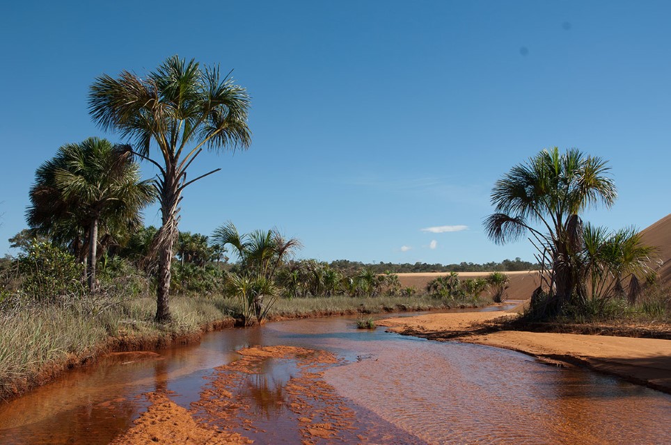
Aguas Claras 5
Clearwater stream in the Jalapão State Park in the Cerrado Region of the Tocantins Basin. Department – Country: Tocantins – Brazil Main Basin – Sub Basin: Tocantins – Tocantins Photographer: Luiz Claudio Marigo
-
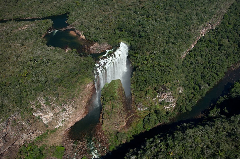
Aguas Claras 6
Waterfall on the clearwater Roosevelt River. Department – Country: Mato Grosso, Brazil Main Basin – Sub Basin: Madeira – Roosevelt Photographer: Luiz Claudio Marigo