Fisheries data for the Estuary Fisheries region (coast and archipelago of the Amazon mouth) come from six cities’ ports: Macapá in the Amazon River mouth; Abaetetuba, Belém, and Vigia in the Marajó Bay; and Curuçá and São João de Pirabas in the Pará Coast. The population of these estuary cities is approximately 1.9 million, representing about 26% of the population of the Amazon’s main commercial fishing zone.
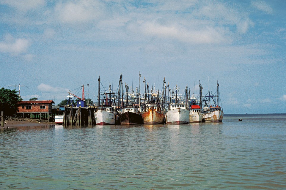
Industrial fishing boats of Belém. Department – Country: Pará – Brazil Main Basin – Sub Basin: Estuary – South Amazon Estuary Photographer: Michael Goulding
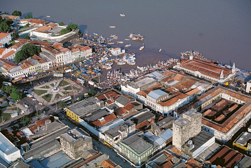
The main fishing ports in Pará are in Belém (1.3 million people), the capital. Belém supports both private and public fishing ports. Belém fishing ports alone account for approximately three-fourths of the total potential estuary yield, or nearly 47,000 tons. The most important public fishing port is Ver-o-Peso, which receives approximately 28% of fish landed in Belém. The remaining 72% is distributed among various fishing ports of several fish companies.
Macapá, the capital of Amapá with a population of 400,000, is the most important city of the Amazon River mouth. Macapá has one public and several private fishing ports. The public fishing port receives fish caught in the estuary, in inland lakes of the coast, and in the Lower Amazon fisheries region. The total potential yield of Macapá was estimated to be approximately 5,400 tons, or 8% of the total estuary catch. Other fish ports include Vigia with 40,000 people and Abaetuba with about 100,000 people.
The potential yield of the estuary region is composed of freshwater and marine species. Freshwater species are more easily captured by the present fishing fleet and represent 77% of the estuary potential. However, marine fisheries may change this situation in the near future if the exploitation of other fish and crustacean species becomes economically viable.
The general fish landing of the estuary is diversified. There are at least 100 species or groups of species that are exploited commercially and 21 of them are responsible for about 90% of total yield potential. Freshwater and marine catfishes are the most important fish group of the estuary, representing more than half of the regional fish potential. Freshwater and marine croakers are the second most important group (10%), followed by marine shrimp (8%) and snappers (5%). The species most intensely exploited by the industrial fisheries, piramutaba and marine shrimp, are responsible for about 40% of potential yield of the estuary.
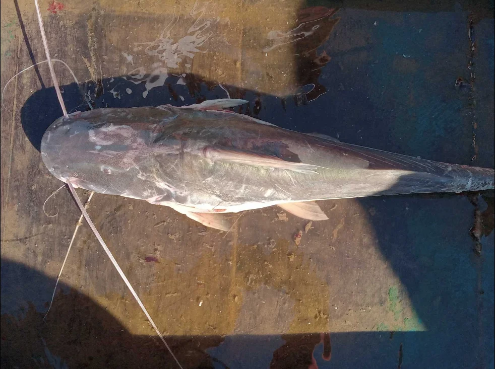
Manitoa (Brachyplatystoma vaillantii). Base de datos de Cornell Lab Ictio. © Cientista Ciudadano anónimo.
Piramutaba (Brachyplatystoma vaillantii), a freshwater catfish, is the most studied species in the estuary because of its commercial importance and it is also one of the few Amazon fish species that are undoubtedly overexploited. The Brazilian Institute of Environment and Renewable Natural Resources (IBAMA) monitors industrial yield and fishing effort and periodically a committee meets to establish piramutaba limits for the industrial fishery. Maximum piramutaba yields peaked in 1977 at 28,000 tons and minimum yields of 6,000 tons were recorded in 1992. Fishing effort at this time was measured as the number of boat trips per day.
Maximum fishing effort for piramutaba peaked in 1980. By the end of the 1980s capacity increased by one-third with the introduction of a new trawl fishing technique. Three boats were used to drag two trawls at the same time. Some companies even implemented other combinations, with an apparent maximum of six boats with five trawls. Refrigeration plants also decreased the acceptable size of fish to be processed, with the intention of maintaining fish yields. In the 1990s catch limitations were imposed on the industrial fishing fleet in an attempt to maintain sustainable catches. Measures to limit catches included restricted fishing areas, minimum mesh size of the cod-end of trawls, maximum number of fish boats and closed fishing seasons. Piramutaba stocks have not yet recovered and further restrictions are planned but not yet implemented.
Fishing Areas and Zones
The spatial distribution of the fish production in the estuary was based on data from public fishing ports of Belém, and on data for piramutaba captured by industrial companies. The potential yield of each fishing area is defined as the maximum annual landing by species since 1994. Two fishing areas were defined: continental and coastal.
The coastal fishing areas are influenced by the seasonality of Amazon River discharge and the the North Brazilian Current and four fishing zones with distinct fishing fleets and catch composition are recognized. The main fishing zone in the Estuary fisheries region is the Amazon River mouth, where there is a potential yield of about two-thirds of the total estuary catch. The industrial fleet is responsible for most of the Amazon River mouth yield. Fish catch in the North and in the Amazon River system (including the Lower Amazon and Central Amazon fishery regions) have potential yields that account for about 8% each of the total estuary catch. The potential yields of Marajó Bay and Marajó Island are 7% and 5%, respectively. The saltwater and Tocantins zones represent approximately 3% each of the total Estuary catch.
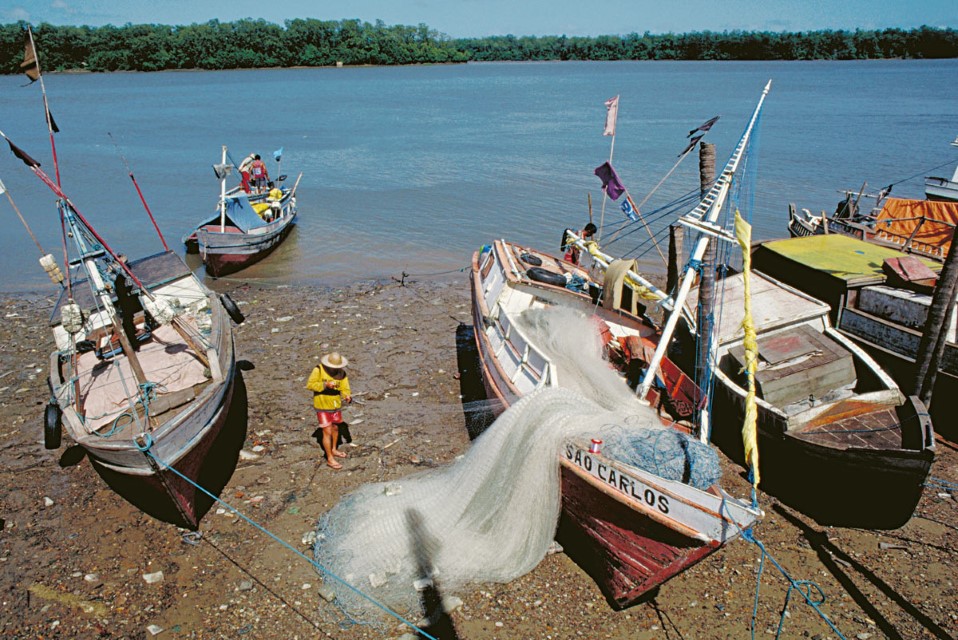
Gill nets being embarked on fishing boats in Vigia in Amazon estuary. Photographer: Michael Goulding
The North area extends along the Amapá coast from Cabo Norte, north of the Amazon mouth, to Cape Orange, at the border of Brazil and French Guiana. Trawler boats fish in deeper waters where they exploit mostly shrimp. In shallow waters gill nets as long as 10 km are used over the bottom to capture mainly marine and estuarine fish species. The depth along that coast is shallow and usually less than 5 meters and tidal bores are also very common. Shallow coastal waters and tidal bores somewhat limit access to fishing along Amapá’s coast. About 90% of the potential yield of the North fishing zone is accounted for by eight species, of which 64% are marine and freshwater croakers (pescada amarela, pescada and corvina). Pescada amarela alone accounts for 40% of this catch. The potential yield of marine and freshwater catfish (gurijuba, dourada and uritinga) in the North is 22% of total catch; sharks and skates (bull shark, black-tip shark, hammerhead, large-tooth sawfish and stingrays) account for 4%; and other marine species such as tarpon, mullet and snook represent the rest.
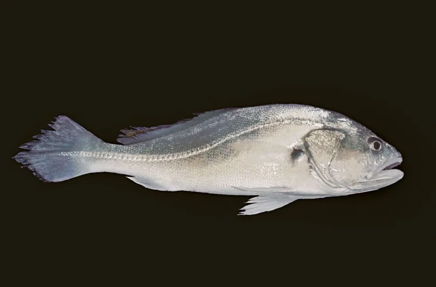
Pescada (Plagioscion squamosissimus)
The Amazon mouth extends from Cabo Norte to Cabo Maguary at the extreme eastern end of Marajó Island. The area is divided by two main channels: the North and the South Amazon Channel. Between them, there are several large shallow banks. The deepest part reaches about 20 m but average depth is less than 10 m. Freshwater outflow maintains the salt wedge outside of the Amazon River mouth. Trawler fishing boats that target piramutaba dominate this fishery. The potential yield of piramutaba alone is approximately 64% of the total Amazon River mouth yield. Other fishing boats operating in this zone exploit marine and freshwater catfish (dourada, piramutaba, piraíba, bagre and gurijuba) and freshwater croakers (pescada). The yield of 11 species accounts for 90% of the potential yield taken by all types of fisheries in the Amazon River mouth zone. In this zone there is conflict between gill net and trawl fishermen, especially when the latter pass over the former during their fishing operations.
Marajó Bay is the smallest fishing zone of the Amazon coast. The dense human concentration along this bay, exemplified by Belém, makes this fishing zone very important for small and middle-sized fishing boats. The Marajó Bay zone ranges in the west from the mouth of the Pará River to Cabo Maguary and Ponta Tijoca in the east. Water depth in this zone is highly variable because of sand banks and rocky bottoms. Average depths, however, are still greater than those of the Amazon River mouth zone. Fishermen usually fish with gill nets or trotlines in one of the three main channels of Marajó Bay, or on rocky bottoms, at depths between 10 and 20 m. The catch composition is dominated by croakers and catfish, which account for approximately three-fourths of the total yield of this zone. Pescada (21%) and dourada (19%) have a similar potential yield, followed by pescada amarela (14%). Twelve fish species account for 90% of the potential yield of Marajó Bay.
Salgado is the saltwater area of eastern Marajó Bay and delimited by Ponta Tijuca on the west and the border of the states of Pará and Maranhão on the east. The Salgado zone is mostly a marine environment. During the rainy season, however, local rivers can dilute marine water and this allows the freshwater dourada to enter this zone. Fisheries in the Salgado zone are diverse and include shrimp trawlers, long-lines for snappers, traps for lobsters and drifting gill nets for various fish species. Drifting gill nets account for most of the catch and the most important species captured are marine croakers (pescadinha gó and pescada amarela), mullets and mackerel. Dourada is the most important freshwater species captured in the Salgado zone and it accounts for approximately 5% of total potential yield. Six marine species account for at least 90% of total potential yield. Catches are sold mostly in local markets of several cities along the Pará coast, but there are also refrigeration plants that redistribute Salgado catches to other cities.
Fish yields of Marajó Island, the only continental fishing area of the estuary, are based mostly on four species, which together are responsible for about 90% of the island’s total yield potential. Tamoatá is the most important species captured from inland waters of Marajó and represents two-thirds of total catches from this zone. Tamoatá landings have decreased in the last few years, most likely because of overexploitation, though few data are available.
The estimated yields given above for each area are not stable. The yield from Marajó Island decreased by about one-third from 1990 to 2000 and the yields from the Lower Amazon fishing region decreased by about half during the same period. In contrast, the yield from the North fishing zone has tripled and that of the Amazon River mouth region has increased by 50%. The probable causes of these changes are related to overfishing on Marajó Island and increased competition between commercial and local fishermen of the Amazon River.
Gallery
-
Estuario 2
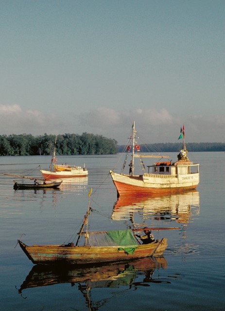
Small fishing boats of the Amazon estuary near Vigia. Photographer: Michael Goulding
-
Estuario 3
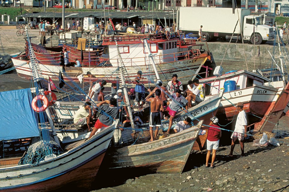
Fishing boats at waterfront of Vigia in Amazon estuary. Department – Country: Pará – Brazil Main Basin – Sub Basin: Estuary – South Amazon Estuary Photographer: Michael Goulding
-
Estuario 5
Ver-o-Peso, the most important public fish market in Belém. Photographer: Michael Goulding
-
Estuario 6
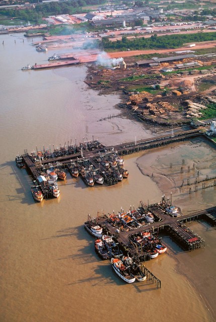
Industrial fishing fleet of Belém. Department – Country: Pará – Brazil Main Basin – Sub Basin: Estuary – South Amazon Estuary Photographer: Michael Goulding
REGION
Central Amazon
Bz-Co-Pe Border
Estuary
Lower Amazon
Peruvian Amazon
Juruá
Purus
Madeira
Upper Madeira
Tocantins

