The important commercial fisheries regions in the Amazon Basin are associated with areas of high biological productivity. Most biological productivity takes place on floodplains or in the estuary. River channels connect the vast floodplain system with the estuary to form the continuous environment that is exploited by commercial and subsistence fishermen of cities and rural settlements.

Relative percentage of maximum captures of Amazon fisheries by regions. The Central Amazon and Estuary are the most productive fisheries regions. Source: Goulding, M., R.B. Barthem, E.J.G. Ferreira e R. Duenas. 2003. The Smithsonian Atlas of the Amazon. Washington: Smithsonian Books.
Fishing and Amazonian cities
The largest cities in the Amazon are usually close to major fishing areas. In general local fish yield is proportional to urban populations. Some cities, however, such as Leticia (Colombia), Iquitos, Pucallpa and Yurimaguas (Peru), Iranduba, Itacoatioara and Boca do Acre (Amazonas, Brazil) and Vigia (Pará, Brazil), have relatively high fish yields in relation to their populations. In these cities fish is exported to other urban areas inside or outside of the Amazon Basin.
Cities that export fish have refrigeration plants and air and/or road connections with other urban centers. Leticia and Iquitos are the two major exceptions that do not have road connections to other major cities. Few of the urban fleets supply international markets because of inadequate hygiene conditions. Only Belém maintains ongoing fish commerce with countries outside of South America.
Cities such as Porto Velho (Rondônia), Rio Branco (Acre) and Marabá (Pará) in Brazil, located at the periphery of the main commercial fishing area in the Amazon, have relatively small fishing fleets. With the population explosion of these cities in the last three decades fish has become relatively unimportant compared to chicken and beef. Subsistence fisheries are scattered throughout the main commercial fish area of the Amazon. Subsistence and commercial fishing are often linked, especially close to urban centers.

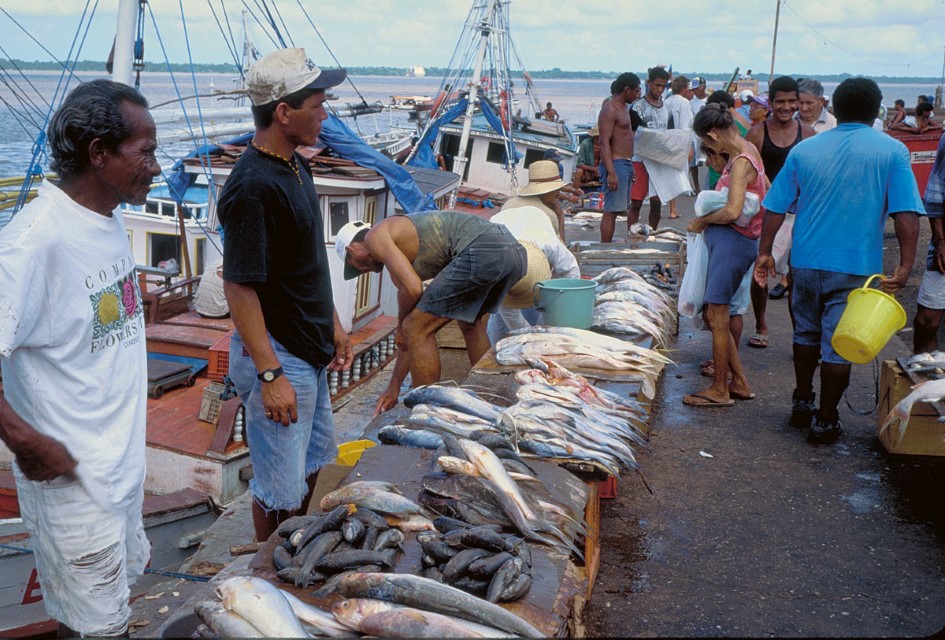
Fish for sale on sidewalk of Ver-o-Peso. Belém, Pará, Brazil. Photographer: Michael Goulding
Classification of fishing regions
Amazon fisheries regions are most easily defined by a combination of urban fishing fleets and the river basins, or the parts of basins they exploit. The Estuary fisheries region is easily identified because of the overwhelming influence of tides that delineate it. The Lower Amazon fisheries region centers on the Amazon River in Brazil from the mouth of the Madeira River to the mouth of the Xingu River. This region is most characterized by huge floodplain lakes that are most exploited by the Santarém and Óbidos fishing fleets. The Central Amazon fisheries region is defined largely by the geographical reach of the Manaus fleet. Manaus dominates the fisheries of the Central Amazon though there are also several other smaller cities that contribute significantly to them. The Brazilian-Colombian-Peruvian Border fisheries region centers on the Colombian city of Leticia from which fish is exported to Bogotá. The Peruvian Amazon fisheries region centers on the Amazon and Ucayali rivers in Peru. Peruvian commercial fisheries are currently widely dispersed and riparian communities ship their catches daily on passenger-cargo boats. Urban commercial fleets are now relatively small. Other major centers of fisheries production in the Peruvian Amazon are Pucallpa on the Ucayali River, Yurimaguas on the Huallaga and Puerto Maldonado along the Madre de Dios River in southeastern Peru.
Because the lower courses (approximately 300 km) of the Madeira, Purus and Juruá rivers are dominated by the Manaus fleet they are included in the Central Amazon fisheries region. The Madeira fisheries region is located from about the mouth of the Aripuanã River to Porto Velho. The Upper Madeira fisheries region includes all of the lowland Madeira River tributaries above the Madeira River rapids.
Fishing statistics
Despite the importance of commercial fisheries in Brazil, Peru, Colombia and Bolivia, few Amazonian cities in these countries collect reliable statistical data. Peru has a long history of collecting data on its Pacific anchovy fisheries, some of the most important in the world. In the northeastern Amazon of Peru, DIREPRO (Dirección Regional de la Producción) has collected regular fisheries data since 1980. In southeastern Peru centering on the Madre de Dios River, fish yields have not been collected by government agencies, but only sporadically by Conservation International (CI) and the Asociación para la Conservación de la Cuenca Amazónica (ACCA). Data for refrigeration plants in Leticia, Colombia have been recorded since 1977 by the Instituto National de Pesca y Acuicultura (INPA), though there are many years for which reliable data are missing.
Brazil is the largest Amazon country and it has several important fishing ports, but few of them have reliable fisheries statistics. Manaus is the largest city and its fishery yield has been recorded since 1976 by governmental research institutions and universities, though there are many years without reliable data. Fishery statistics for Belém are mostly for the industrial fleet exploiting piramutaba and marine shrimp and data are available from IBAMA (Instituto Brasileiro do Meio Ambiente) going back to the early 1970s. Fisheries data for the local Belém fleet and other estuary ports are only available since the early 1990s. There are long-term fisheries data for Porto Velho on the Upper Madeira since the early 1970s because records have been kept by the local fisheries cooperative for taxation purposes.
The sum of the estimated maximum annual yields of the 66 main cities analyzed in the Amazon basin was 173,000 tons. Based on the most recent census estimates, there are 7.1 million people in the cities of the main Amazon commercial fishery regions defined here. If the total potential maximum yield were divided among the total population, then per capita consumption would be 24 kg/year, or approximately 600 grams/day. In reality per capita consumption is lower because fish is exported and average yields are lower than maximum estimate yields.
The Central Amazon, Estuary and Peruvian Amazon contribute the most to annual yields. The potential fish yield from these three regions represented approximately three-fourths of the total estimated yield from all Amazon fisheries regions. These three regions also contain approximately two-thirds of the total population, or 4.7 million people. The Brazilian-Colombian-Peruvian Border and the Tocantins regions each account for approximately 7% of the total maximum fish yield in the Amazon. Whereas the Tocantins region has 7% of the total population, the Brazilian-Colombian-Peruvian Border region has less than 1% of the population. Most fish is exported from the Brazilian-Colombian-Peruvian Border region.
The potential yield from all other fishery regions was 7% of the total, or 11,700 tons of fish, but these regions have 20% of the total population, or 1.3 million people. The potential yield of the Purus, Madeira and Upper Madeira fishery regions was about 2% to 3% of the total Amazon yield. The Juruá fishery region is the least populated (2%) and has the lowest potential fish yield (1%).
Gallery
-

Biodiversidad 2
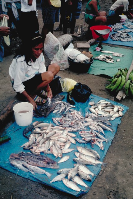
Fish vendor in Pucallpa on the Ucayali River, Peru. Photographer: Michael Goulding
-

MichaelGoulding_99003-1001
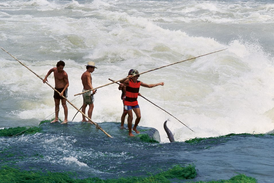
Gaff fishing at the Cachoeira de Teotônio of the Rio Madeira. Photographer: Michael Goulding
REGION
Central Amazon
Bz-Co-Pe Border
Estuary
Lower Amazon
Peruvian Amazon
Juruá
Purus
Madeira
Upper Madeira
Tocantins

