

The Amazon Estuary
The eastern wetlands near the Amazon River mouth region consist of a complex maze of archipelagoes, a giant island, an enormous and largely freshwater bay and tidal forests; they are the meeting area of Amazon and Atlantic waters. In the battle between fresh water and saltwater, the fresh water largely dominates the ecology of the eastern region. Amazon River discharge forms a bulwark against marine water and the coastal wetland savannas are dominated by rainwater. The marine influence is most easily detected by the presence of mangroves near the ocean.
The Amazon estuary centers on the giant island of Marajó (40,000 km2) around which Amazon River water flows. The main Amazon River channel meets the Atlantic north of Marajó Island but part of the river also flows south and then northeast through Marajó Bay. Due to the Amazon River’s huge discharge its estuary is largely fresh water. The Amazon coastal region stretches from the Oiapoque River at the Brazilian-French Guiana border to just southeast of Marajó Bay. Most of this area is not hydrographically in the Amazon Basin. However, from the viewpoint of Amazon wetlands management, it should be considered as ecologically connected. The presence of migratory freshwater catfish attests to its ecological connection with the main river system.
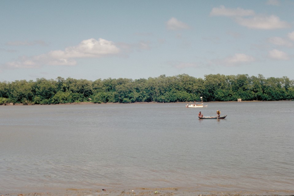
Department – Country: Pará – Brazil Main Basin – Sub Basin: Estuary – South Amazon Estuary Photographer: Michael Goulding
The Amazon coastal region stretches from the Oiapoque River at the Brazilian-French Guiana border to just southeast of Marajó Bay. Most of this area is not hydrographically part of the Amazon Basin. However, from the viewpoint of Amazon wetlands management, it should be considered as ecologically connected. The coastal area where the Amazon River flows into the sea is characterized by its muddy shores, as it receives a huge load of sediments transported by the water.
This area represents the confluence of the waters of the Amazon River and the Atlantic Ocean. In this struggle between freshwater and saltwater, freshwater overwhelmingly dominates the ecological processes occurring in the region. Records of strictly freshwater catfish captured in these Atlantic coastal zones attest to the dominance of freshwater in the nearshore marine ecosystem and its ecological connection with the main river system. This occurs because the water and sediments discharged by the Amazon River into the Atlantic form a barrier against marine water, and because the coastal wetland plains are nourished by rainwater. However, marine influence is also significant and can be detected by the presence of mangroves near the ocean. A broad wetland zone can be found around the mouth, consisting of a complex labyrinth of archipelagos, a giant island, a massive freshwater bay, and tidal forests.
The enormous Marajó Island and its internal delta create a labyrinth of riverine landscapes and forests. Most of Marajó Island is surrounded by freshwater from the Amazon, and although the portion facing the Atlantic Ocean accounts for only one-third of the giant island’s coastline, it is characterized by large quantities of mud and an extensive area of mangroves, as well as sand dunes and vast bamboo thickets. These sand dunes sharply contrast with the muddy plains at the mouth of the Amazon.
Annual fires set by cattle ranchers have radically altered the northeastern coast of Marajó Island, and the bamboo thickets are likely a consequence of extensive fire use in the area.
Environmental planners have overlooked the Amazon River mouth in their land management proposals, mainly due to the limited knowledge surrounding it. The northern coast, in the Amapá region, remains relatively underdeveloped economically so most of the mangrove forests found there are in good condition and little or not intervened, primarily used for crabbing, with very little commercial fishing occurring offshore. The waters near the northeastern coastline of the island represent important nursery habitats for commercially important catfish.
However, to the east of the Amapá savannas, cattle ranching activities are expanding and have generated some impact on the coast as animals invade some of the tidal streams. On the other hand, there are still large and impressive stretches of freshwater tidal forests on some of the islands along the coastline that are threatened by deforestation occurring inland and the burning of the savannas. Given the aforementioned points, and considering that the population settled in the mouth area is small, likely due to the difficulties of navigating because of the large amounts of mud, and that this area is currently unprotected in any way or to any extent, establishing a small reserve to protect the vast eastern expanse of floodplain forests and wetlands here would be ideal.
-
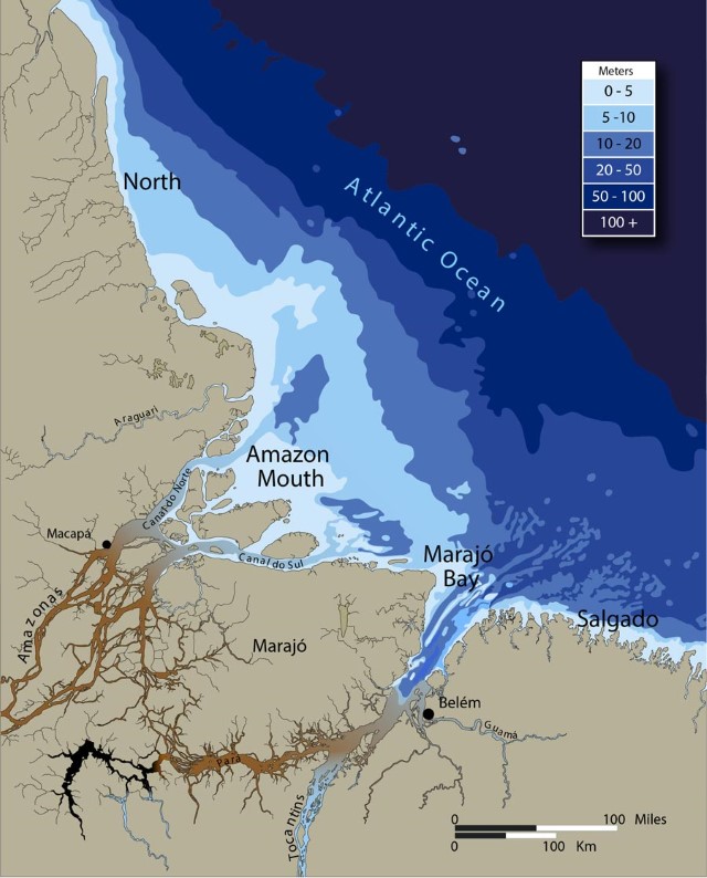
Map_00003-1001_Estuary-fishing-zones
Because of the huge sediment load of the Rio Amazonas the estuary is relatively shallow, especially in the mouth and northern areas. Most commercial fishing for freshwater species takes place in depths less than 50 meters.
-
MichaelGoulding_HiRes_000330
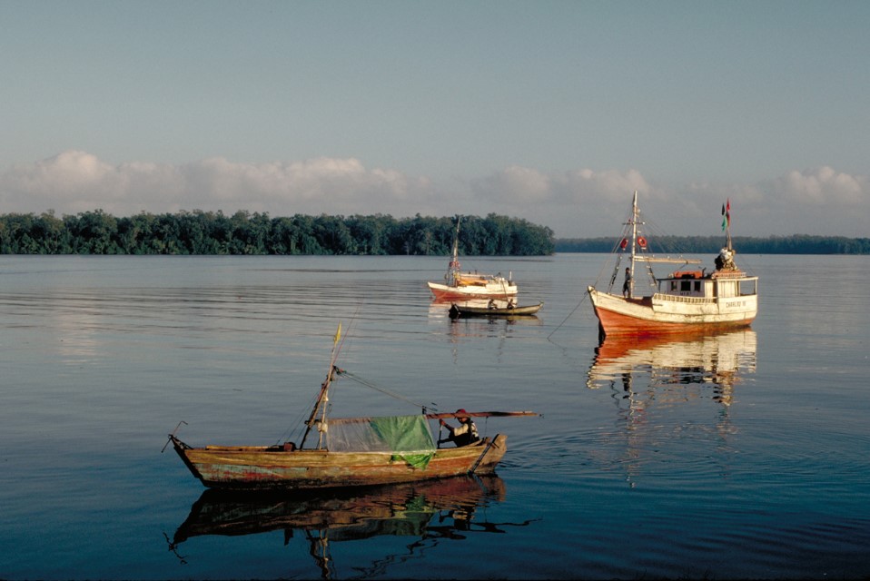
Marajo Bay and islands in front of the city of Vigia. Department – Country: Pará – Brazil Main Basin – Sub Basin: Estuary – South Amazon Estuary Photographer: Michael Goulding
-
MichaelGoulding_HiRes_000404
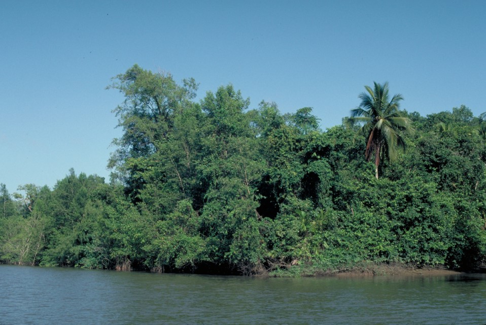
Department – Country: Pará – Brazil Main Basin – Sub Basin: Estuary – South Amazon Estuary Photographer: Michael Goulding
-
MichaelGoulding_HiRes_000927
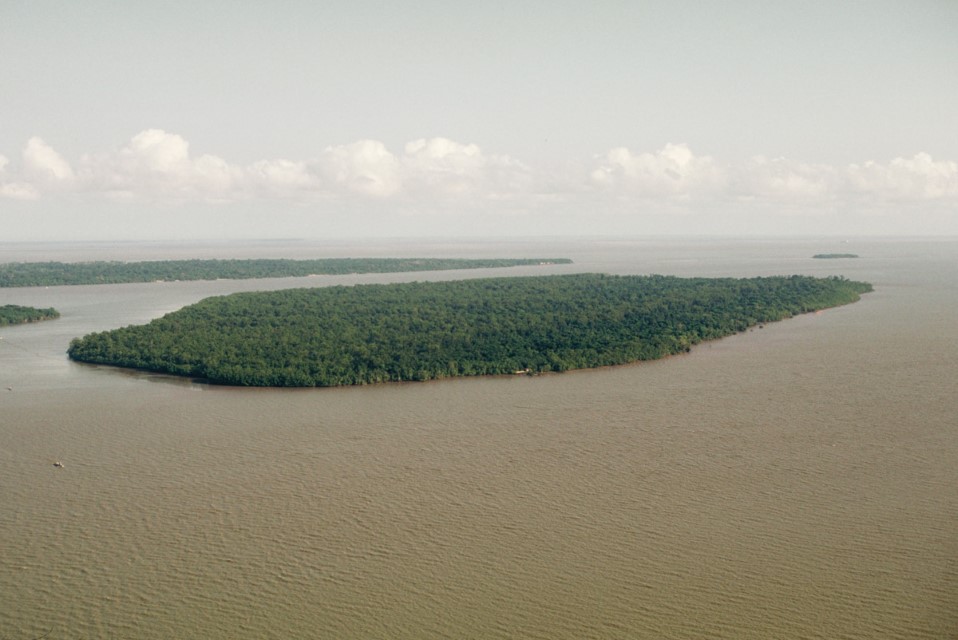
Tidal forest island of the Amazon estuary near Belem. Department – Country: Pará – Brazil Main Basin – Sub Basin: Estuary – South Amazon Estuary Photographer: Michael Goulding
-
MichaelGoulding_HiRes_003514
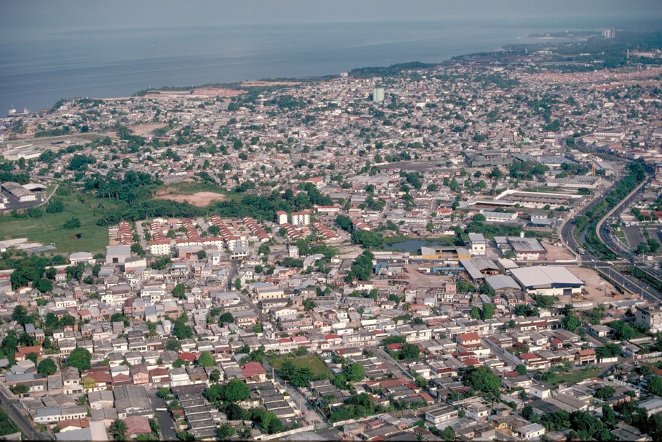
Belém near the upstream entrance of Marajo Bay. Department – Country: Amazonas – Brazil Main Basin – Sub Basin: Negro – Lower Negro Main Stem Photographer: Michael Goulding
-
MichaelGoulding_HiRes_009757
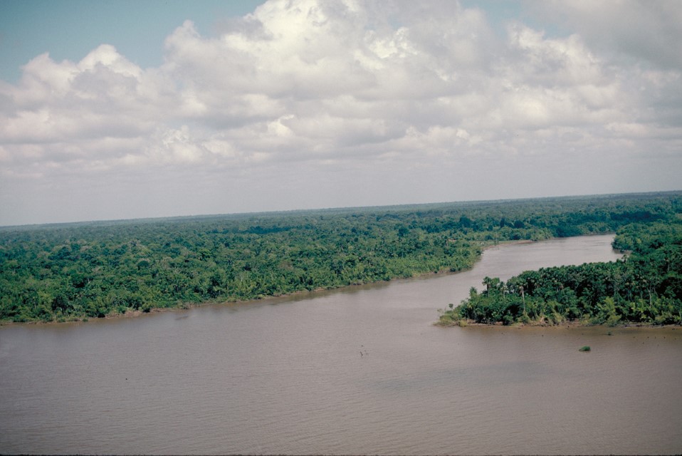
Department – Country: Amapá – Brazil Main Basin – Sub Basin: North Amazon Estuary – North Amazon Estuary Photographer: Michael Goulding
-
MichaelGoulding_HiRes_011261
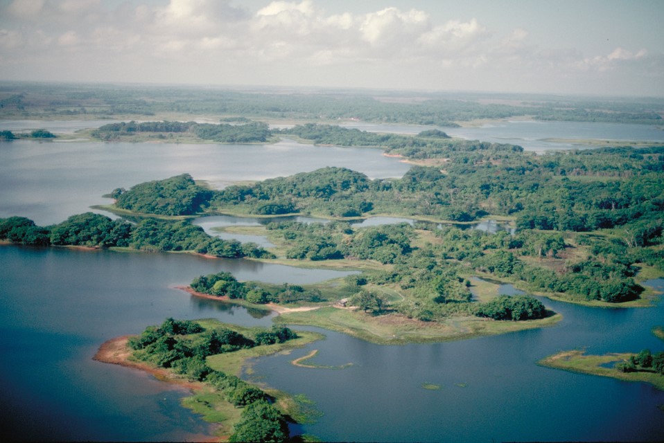
Department – Country: Amapá – Brazil Main Basin – Sub Basin: North Coast Basins – Araguari Photographer: Michael Goulding