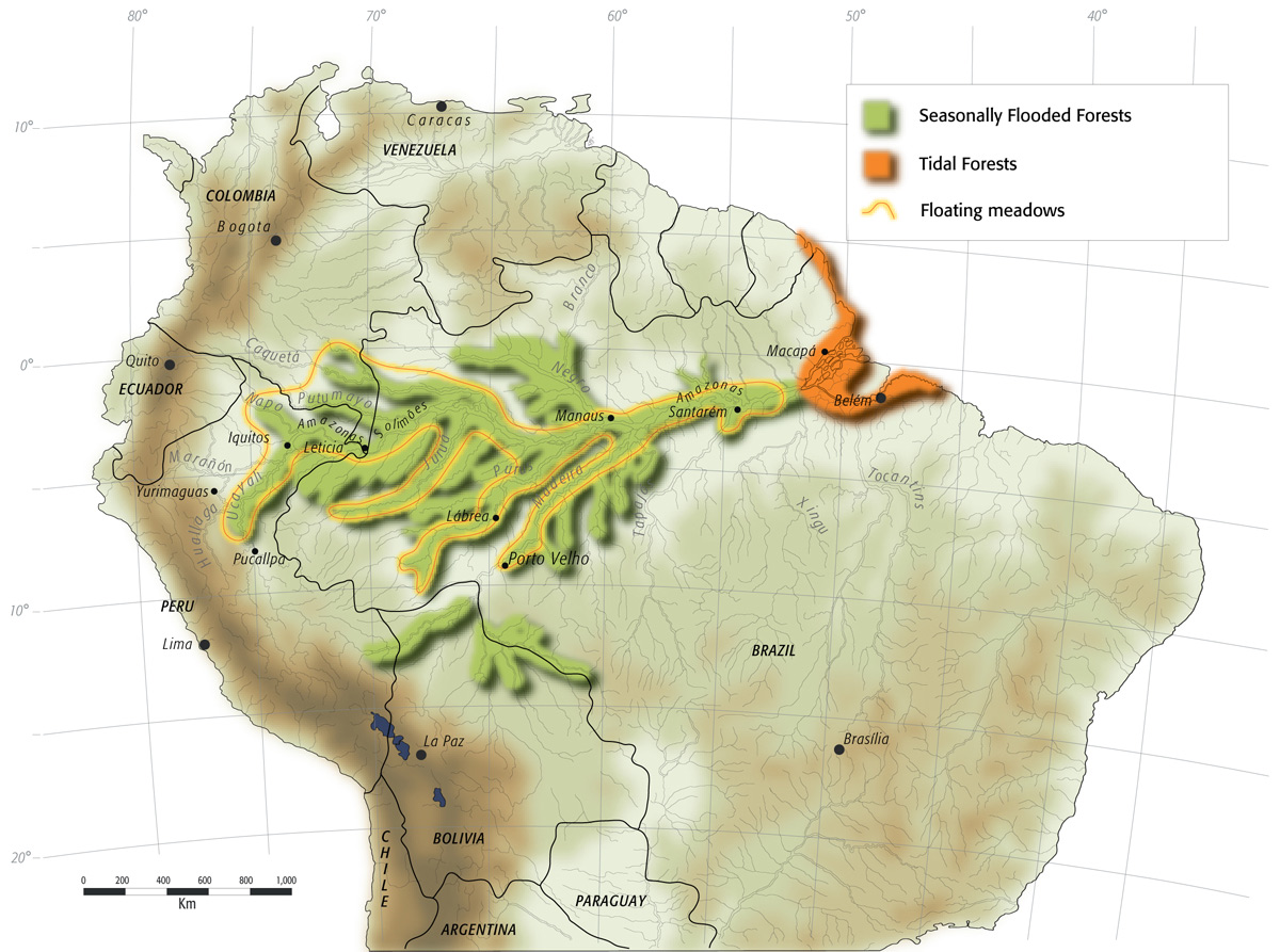
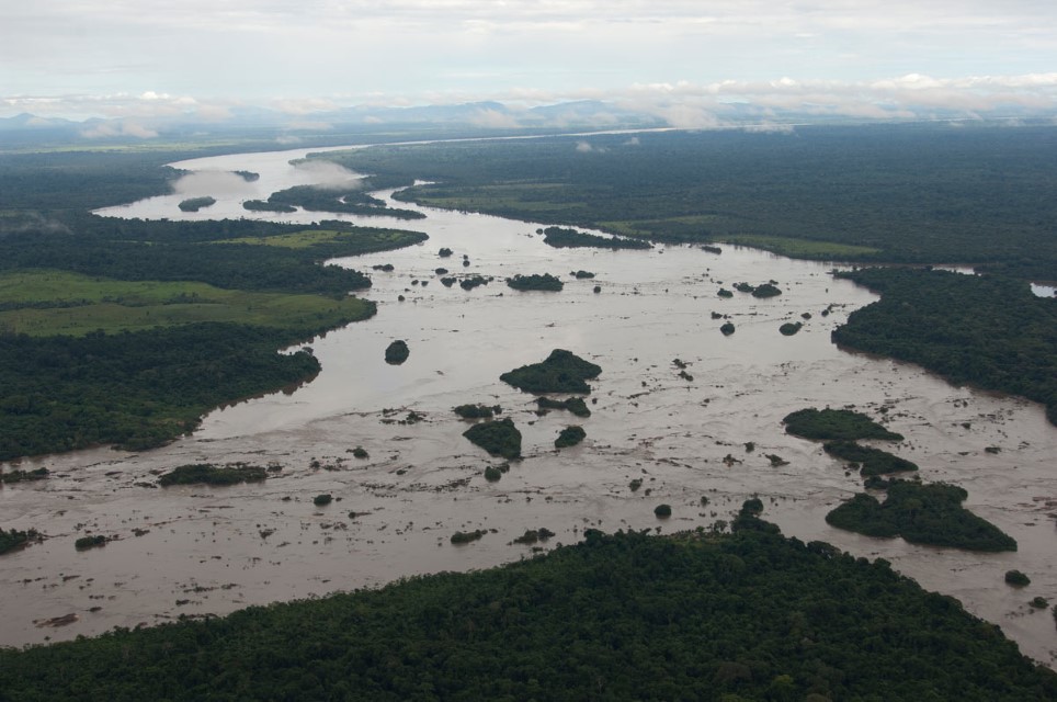
The floodplain along the Rio Amazonas, including that of the Rio Ucayali, extends 4,800 km from the Atlantic to south of Pucallpa in Peru. Several of the Rio Amazonas”s largest tributaries, such as the Rio Purus and Rio Juruá, also have immense floodplains. Near the Rio Amazonas mouth, floodplains can reach 200 km in width. In general there is an east to west decrease in floodplain width, the major exception being the confluence of the Rio Ucayali and Rio Marañón in Peru where the floodplain is at least 80 km in width in some places. The area subject to flooding along the Rio Amazonas is approximately 78,000 km2 and there are an additional 62,000 km2 of floodplain along the lower reaches of the Rio Madeira, Rio Purus, Rio Juruá and Rio Negro. River islands account for a relatively small percentage of total floodplain of the Rio Amazonas and its major whitewater tributaries. The estuary, however, has many river islands. Seasonal river level changes cause great variation in the inundated area. For example, excluding channels, the total flooded area of the Rio Amazonas varies from 10,000km2 to 81,000 km2.
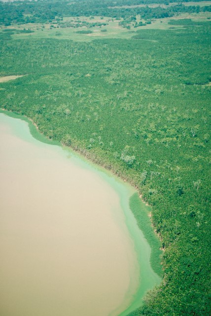
The várzea floodplain environment contains the most important fishing habitats in the Amazon Basin. The floodplains of the Amazon are a mosaic of habitats that include levees, lakes, dried lake beds, swampy depressions, sand or mudflats and gently inclined slopes. Depending on exact elevation, habitats range from permanently aquatic to nearly permanently terrestrial. The two main types of vegetation found on floodplains are forests and floating meadows. The herbaceous plants that form floating meadows are most abundant in the whitewater rivers because of the greater availability of nutrients. Herbaceous plants have short life cycles and can be highly productive. Forests subject to inundation are found on the floodplains of all types of rivers. Those of the whitewater rivers are referred to as várzea forests and those of the blackwater and clearwater forests are usually called igapó forest. In contrast to floating meadows, forests have lower net productivity but a much larger standing biomass.
In areas where there is not major deforestation, forests cover approximately one-third of the floodplain.
Floodplains can be inundated by river overflow, local rainfall, or tides. Most of the large floodplains of the Amazon are inundated by river overflow and may be referred to as seasonally inundated floodplains. Only in headwaters and along rainforest streams is flooding controlled by local rainfall. Flooding in the estuary is dominated by the tides. Flooding time and depth vary along the length of the Rio Amazonas. Outside of the estuary flooding is monomodal, with a distinct wet and dry period. In the Lower Amazon the flood curve has a symmetric sine format with nearly equal numbers of days when the river rises and falls. River level fluctuation of the Lower Amazon ranges from 4.0 to 7.5 meters. The flood curve of the Central Amazon has an asymmetric sine format with a larger number of days when the river is rising than when it is falling. River level fluctuation in the Central Amazon ranges 9 to 14 meters. Toward the west, at the Brazilian-Colombian-Peruvian border, the flood curve is more irregular and river level fluctuation is 8 to 10 meters. Flood levels can vary considerably though in general they do not. There are extreme years when floods are minimal or when they can be very large. For example, the average river level fluctuation at Manaus is 9.5 meters, though there are years when it has been 14 meters.
The three most important habitats exploited are the open waters of lakes, floating meadows and flooded forests. Lake fisheries occur in all months but expand and contract with lake dimensions. Fish are commonly captured moving between river channels and floodplain lakes. Floating meadows and flooded forests are fished mostly during the six-month high water season. The largest floodplain lakes are found between the mouth of the Rio Madeira to just downriver of Santarém. The largest are Lago Grande de Monte Alegre and Lago Vila Franca, both in the Lower Amazon. Floating meadows are important to fish life because they provide protection from predators. There is still considerable debate as to what extent they are important in the food chain of fishes.
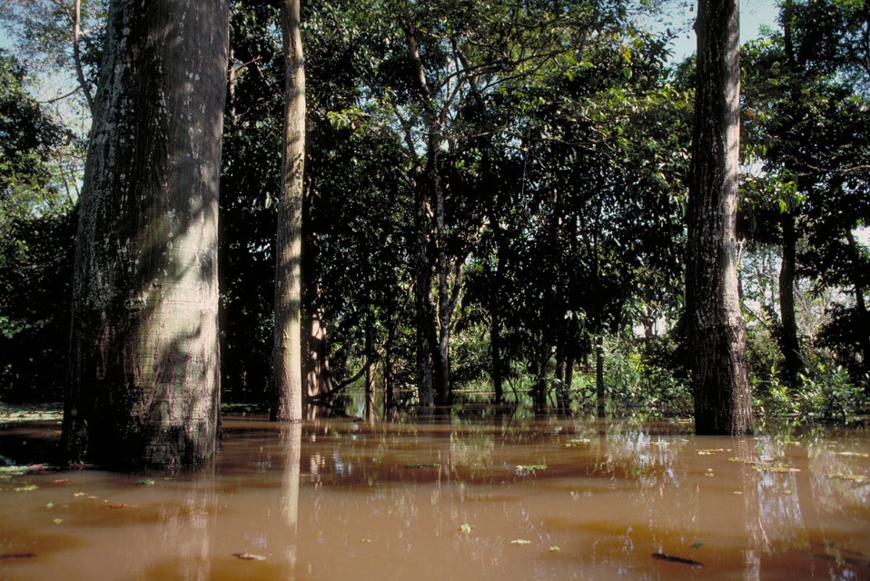
Few fish species feed directly on herbaceous plants but there are a large number of detritivores, many of which are important in commercial fisheries that probably feed on detritus derived largely from decaying floating meadows. Fishing in floating meadows is also difficult, thus these herbaceous plant communities play an indirect role in protecting fish from overexploitation by fishermen. Depending on the exact location, floodplain forests become inundated with up to 8 meters of water for four to nine months each year. Most floodplains in the Central Amazon are inundated with 2 to 5 meters of water. There are many fruit- and seed-eating fishes in the Amazon and many are important market species. The frugivores depend on fruits and seeds that fall out of the flooded trees.
There are also many insect- and spider-feeding fishes that depend on várzea and igapó forests. Although few data are available it appears that most fish enter the flooded forest during the high water period for protection, feeding, or breeding. Migratory food fishes, however, breed outside of the flooded forest. The flooded forest is probably even a more important habitat than floating meadows for protecting fish from overexploitation by fishermen.
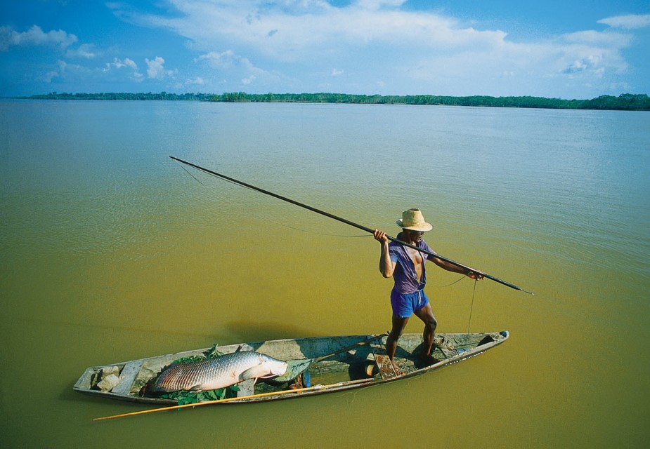
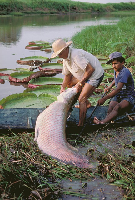
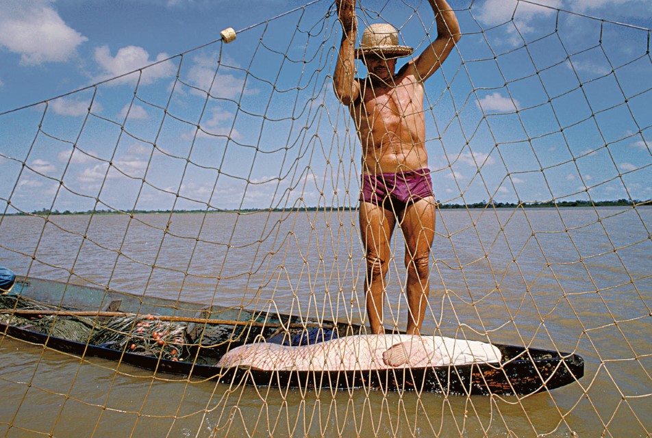
Várzea fishing techniques are diversified because of high species diversity and changing water levels. Floating meadows and sunken trees often prevent the use of seines. Gill nets are the single most important gear and they are used to catch more than 50 commercial fish species. One of the most traditional fisheries was that of the pirarucu (Arapaima gigas) that was taken mostly with harpoons. Today most catches are made with gill nets, or gill nets are used at least to corral the large fish before they are harpooned.
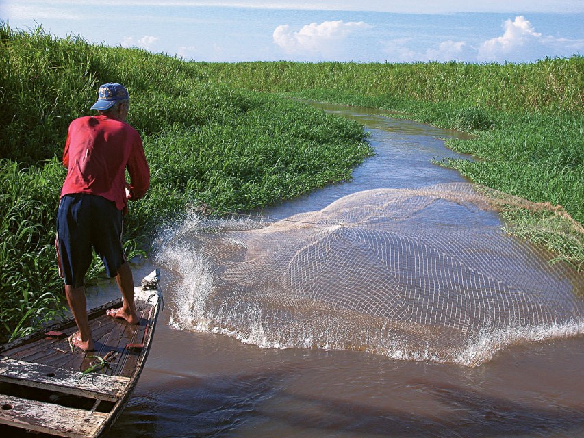
Cast nets, hook-and-line and gigs are also common gear used in floodplain fisheries. Cast nets are most effective during the low water period when water depth is less than 3 meters. In flooded forests gill nets are the principal gear used to catch fish below fruit trees, but pole-line-hook baited with fruits or seeds are widely employed as well.
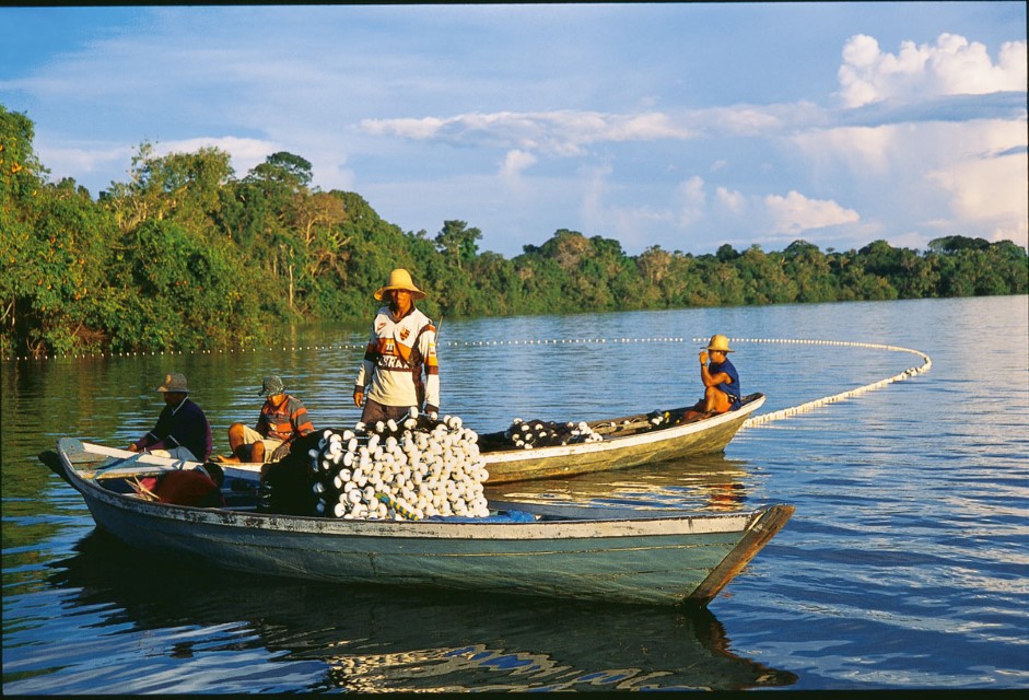
Seines are used in open waters in many floodplain lakes to capture schools of migratory characins sheltered under or near the floating meadows. Large numbers of other species are also captured and those with low commercial value are grouped in a category called salada (salad) by Brazilian fishermen. Mapará fisheries are important in large várzea lakes near SantarÉm. Fishing crews consist of 7 to 12 fishermen, a large boat equipped with ice and several canoes. Gill nets referred to as miqueiras, 60 meters long with 8 to 9 mm mesh, are joined together to form one long net. Catches are sold to public markets or refrigeration plants of the Lower Amazonas, estuary or lower Rio Tocantins.
-
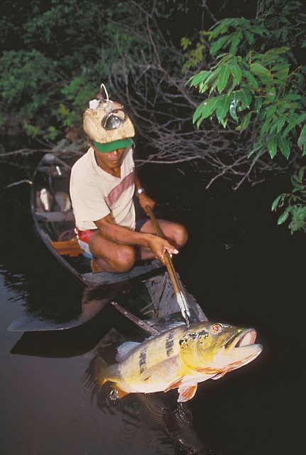
Llanura inundable o Várzea 1
The steel gig was introduced into the Amazon by Portuguese fishermen and is important commercially in tucunaré fisheries. Photographer: Michael Goulding
-
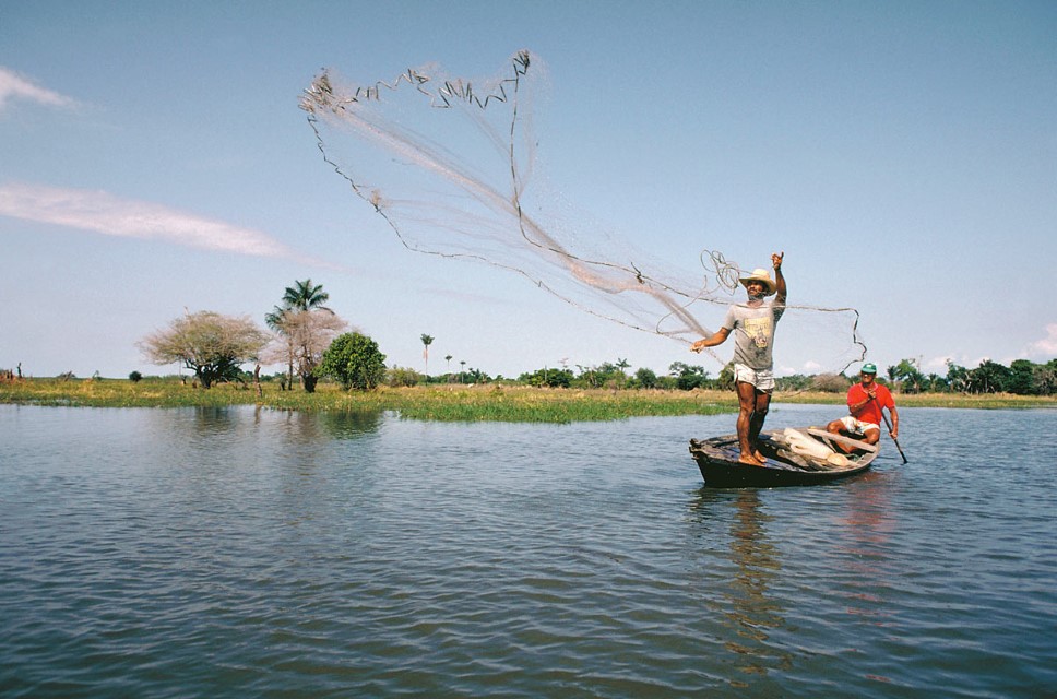
Llanura inundable o Várzea 2
Cast net being used in floodplain lake of Rio Amazonas near Santarém during the low water period. Photographer: Michael Goulding
-
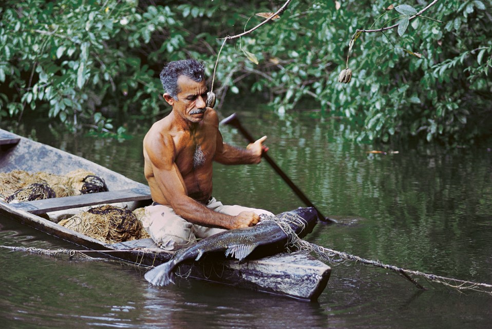
Llanura inundable o Várzea 3
Gill net being used in flooded forest to capture tambaqui (Colossoma macropomum) in Rondônia. Photographer: Michael Goulding
-
Llanura inundable o Várzea 4
Seine fishing in floodplain lake of the Lower Purus. Fish become concentrated in the várzea lakes during Department – Country: Roraima – Brazil Main Basin – Sub Basin: Negro – Branco Main Stem Photographer: Luiz Claudio Marigo
-
Llanura inundable o Várzea 5
Harpoon fishing for pirarucu (Arapaima gigas) in floodplain lake of Middle Rio Solimões. Department – Country: Roraima – Brazil Main Basin – Sub Basin: Negro – Branco Main Stem Photographer: Luiz Claudio Marigo
-
Llanura inundable o Várzea 6
Photographer: Michael Goulding
-
Llanura inundable o Várzea 7
Photographer: Michael Goulding
-
Llanura inundable o Várzea 8
Pirarucu captured in gill net in floodplain lake of Rio Amazonas near Santarém, Pará, Brazil. Photographer: Michael Goulding
-
Llanura inundable o Várzea 9
Large-mesh gill nets are now commonly used, along with harpoon, to capture pirarucu (Arapaima gigas). Photographer: Michael Goulding
-
Llanura inundable o Várzea 10
Photographer: Luiz Claudio Marigo
-
Llanura inundable o Várzea 11
Photographer: Luiz Claudio Marigo
-
Llanura inundable o Várzea 12
Photographer: Luiz Claudio Marigo
-
Llanura inundable o Várzea 13
Fish move between river channel and floodplain lakes via small natural levee channels. Cast nets are commonly used to catch fish in these levee habitats. Department – Country: Pará – Brazil Main Basin – Sub Basin: Amazon Main Stem – Eastern Amazon Main Stem Photographer: Luiz Claudio Marigo
CONTEXT
The Andes
Cataratas
Floodplain or Várzea
River Mouth Bays
River Channel
Estuary & Amazon Coast
Marajó and Inner Delta
