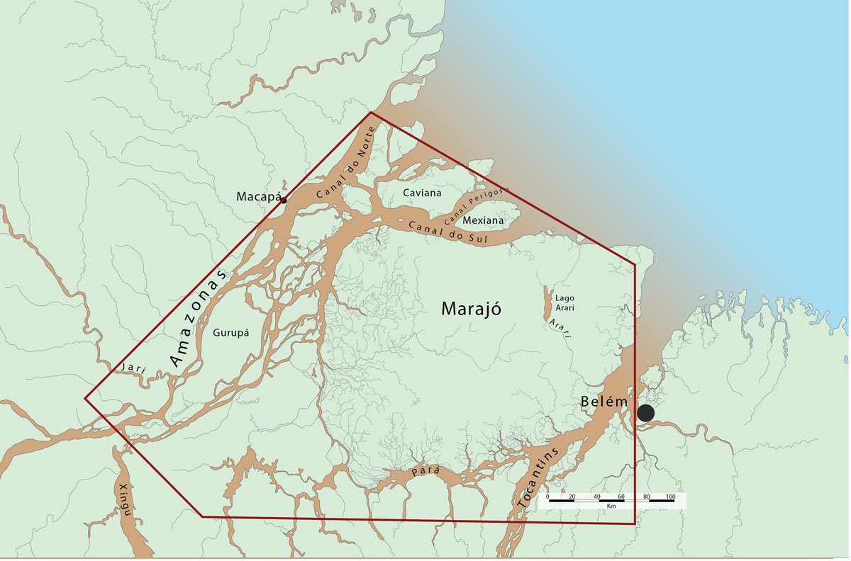
The Amazon River mouth area is very large and extends 340 km between Cabo Norte to Ponta Tijoca. The Amazon River does not have a delta in a strict geomorphologic sense, but rather a complex of large and small islands between the Xingu River and the Amazon River mouth that are sometimes referred to in the literature as an internal delta. Marajó, with 40,000 km², is the largest island. The Amazon River mouth lies to the north of Marajó Island; to the south is Marajó Bay, into which the Tocantins River flows.
The continental shelf (Amazon Shelf) is very large near the Amazon River mouth because of the large amount of sediments that have been deposited, but decreases northwestward toward the Guianas and eastward along the Atlantic coast east of the mouth of Marajó Bay. Tidal amplitudes near the Amazon River mouth are 4 meters and the huge discharge of the river decreases salinity along the Amapá coast. The salinity profile of the Amazon Shelf varies considerably according to seasonal differences in Amazon River discharge. Because of the large discharge the saltwater wedge along the Amazon Shelf is displaced out to sea and never enters the Amazon River. In contrast, in Marajó Bay the saltwater wedge moves approximately 150 km inland during the low water season (June–December) of the Amazon River; during this time there is brackish water in Marajó Bay.
Estuaries are among the most biologically productive waters in the world. Trophic dynamics tend to be complex because of different types of primary producers, including salt marsh plants, mangroves, submerged sea grasses and benthic algae; by contrast, the open ocean is dominated by phytoplankton production. The trophic dynamics of the Amazon estuary largely begin with phytoplankton in open waters and mangrove forests at the margin. Tidal forests replace the mangrove forests in the permanent freshwater tidal zone.
Phytoplankton production along the Atlantic coast that is influenced by the Amazon River is controlled largely by a combination of river discharge, the North Brazilian Current, wind and macro tidal forces. The result is a gradient of different water characteristics from the river to the open ocean. The inner estuary, with depths greater than 40 meters, is controlled by turbid freshwater. The middle estuary is relatively shallow (5 to 12 meters) and the main processes occurring in that zone are the coagulation and precipitation of suspended sediments. In this zone sediments are also constantly resuspended because of tidal currents, wave shoaling, wind and water mixing and by the transfer of heat and matter in the water. The consequence is a high suspended sediment concentration and low primary production, conditions similar to those found in the central Pacific Ocean. The offshore estuary has depths of 7 to 22 meters, less suspended sediment, greater salinity (but still less than marine water, or less than 32 parts/1,000) and higher primary productivity. Productivity in the offshore Amazon estuary zone can be similar to that off the coast of Peru, where upwelling supplies huge amounts of nutrients. Beyond the estuary zone salinity is high (>32 parts/1,000) and nutrient levels and productivity are low.
Amazon River water is pushed out into the Atlantic and then deflected northward by the North Brazilian Current along the Amapá and Guiana coasts. In this large mixing zone the bottom is muddy and the water is generally brackish, but salinity may be reduced to less than 1 part/1,000 in areas near the coast during the highest water levels of the Amazon River. The influence of the Amazon River is reduced along the Pará coast to the east, though local rain can decrease salinity in areas close to land. The bottom of this zone is less muddy than that to the north along the Amapá coast and usually covered with sand or rocks.
The northeastern and southeastern coasts of the Amazon River mouth zone are covered by extensive mangrove forests. The mangrove vegetation extends along the Amapá and Pará coasts and is dominated by Rhizophora mangle, Avicenia nitida and Laguncularia racemosa. The mangrove is also a nursery zone for many estuarine and marine fish and crustacean species.
The fisheries near the Amazon River mouth are diversified, including oceanic, coastal and inner bay operations. This section focuses on the inner bay and coastal fisheries activities whose environments are largely dominated by freshwater. Commercial fishing boats that exploit the coastal region range from canoes to trawlers. Trawlers are typically a steel hull design that can be traced to the double rigger shrimp boats of Florida. Trawler catches are sold largely to industrial plants that process and export fish.
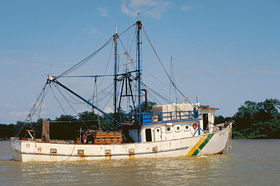
Trawl fishing off the Amazon coast began after the first surveys between 1957 and 1958 of shrimp populations by the American research ship Oregon. The Amazon coastal area is part of one of the most important penaeid shrimp fishing areas in the world, which extends from northeastern Venezuela to the mouth of the Parnaíba River in the state of Piauí, Brazil. Commercial trawl-fishing for shrimp near the Amazon mouth was initiated in the late 1950s by foreign companies already experienced in these types of fisheries. Subsequent to the establishment of 270 nautical mile, or 370 km, fishing limits by the Law of the Sea in 1970, foreign companies continued to exploit the Amazon estuary until 1978 when the international fisheries agreement was ended. Since then only national vessels or Brazilian flag vessels under leasing agreements have operated in the area. Shrimp trawlers range in length from 19 to 25 meters. They are powered by 235 to 540 HP engines and operate double-rigged trawls. The vessels are equipped with instruments for satellite navigation, radio communication, echo sounding and freezing. Some of the vessels are smaller in size and a few of them operate with single trawls. Trawlers remain at sea for 40 to 60 days and usually make five to six trips per year. A trawler crew is made up of five or six men. By 1977 there were 658 registered shrimp vessels operating along the Amazon coast. Today the fleet is limited by Brazilian regulation to 250 vessels.
Shrimp trawlers target two species: Farfantepenaeus subtilis and F. brasiliensis. The most important in the open sea fisheries of Brazil is F. subtilis, but along French Guiana F. brasiliensis is more abundant. Others shrimp species are also captured, such as Xiphopenaeus kroyeri which is fished near the coast, and Litopenaeus schmitti which is captured mainly in the Panaíba Rivere mouth area. The most important shrimp fishing area is located between Cape Orange at the Brazilian/French Guiana border and the mouth of the Parnaíba River. This area is heavily influenced by Amazon River water and shrimp fishing takes place between 10 and 100 meters depth. Fishermen divide this area into three parts. The Maranhão area is dominated by salt water and located between Gurupí River and Parnaíba River. Most fishing is done at 20 to 40 meters over a relatively smooth and hard bottom. The main fishing season is between December and September.
The Amazon area is located near the Amazon River mouth between Marajó Island and the Calçoene River. Fishing depths range from 40 to 60 meters and the bottom can be muddy, sandy or rocky. There are also smooth depressions called pula-pula. The Amapá area is located between the Calçoene River and Cape Orange. Deeper waters, more than 60 meters, are fished here and the bottom is irregular and rocky and a strong current makes fishing more difficult.
A large part of the shrimp catch landed in Belém comes from a zone south of the Amazon River mouth that is referred to locally as the garbage heap (lixeira in Portuguese). This moniker is derived from the large amount of algae that is brought in with trawls. Mostly young shrimp are captured in this area and IBAMA (the Brazilian Institute of Environment and Renewable Natural Resources) has initiated attempts to protect this region because of its importance as a shrimp nursery.
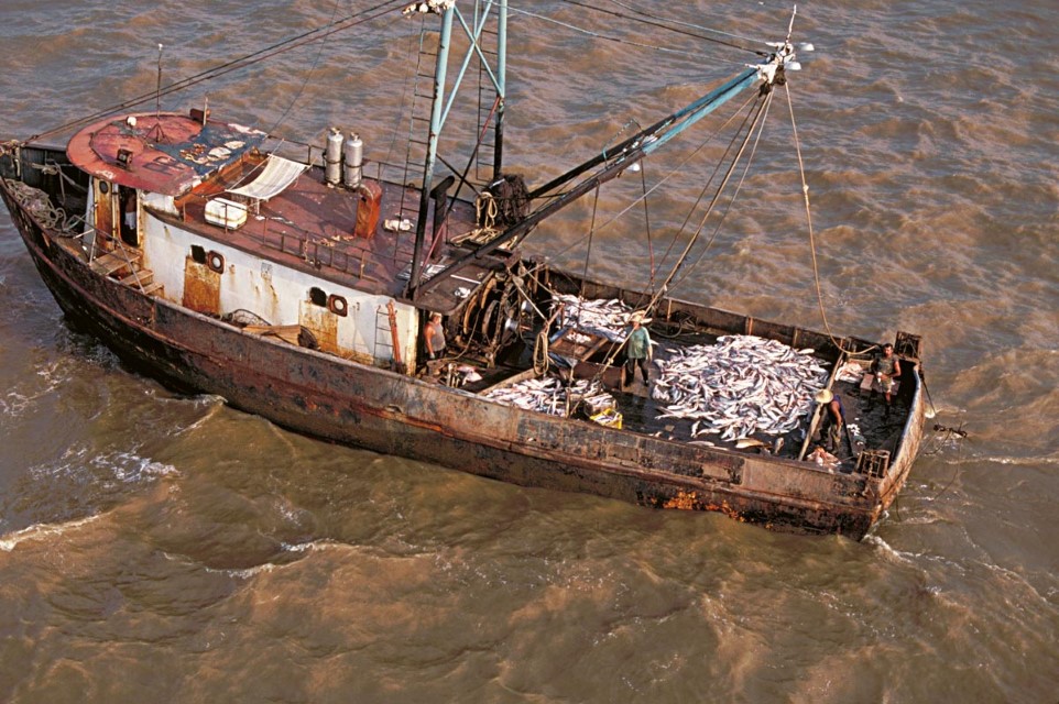
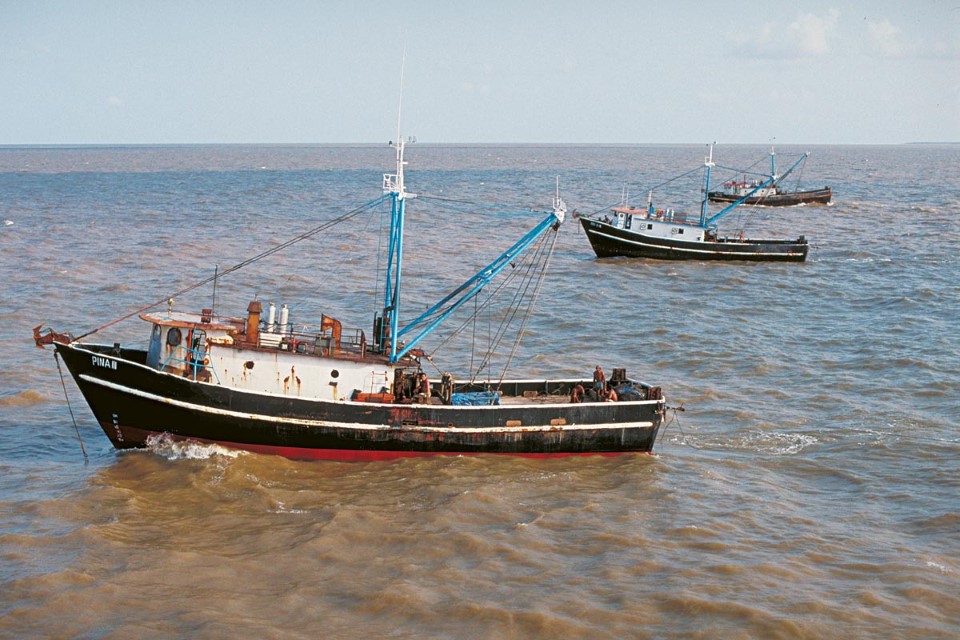
Trawl fisheries increased rapidly in the early 1970s when the Brazilian government offered fiscal incentives to industrial-scale operations to exploit mostly catfish. Catfish operations initially adapted trawl techniques from the shrimp fisheries, but these proved difficult. Japanese fishermen were contracted in 1971 to adapt shrimp boats to exploit catfish near the muddy bottom of the Amazon Shelf. A bottom otter trawl, or pairs of these trawls, was the technique developed for the Amazon Shelf. Fishing boats are 17 to 29 meters in length with ice capacity of 20 to 105 tons (average 50 tons) and powered by 165-565 HP engines. Catfish trawl crews are usually composed of seven men. GPS navigation and sonar are now used by these fishing boats.
The otter trawl for catfish fisheries is usually referred to as the Danish or Portuguese type and measures approximately 45 meters at the opening with a 75 meter length. The recommended mesh size (stretched) of the cod-end is approximately 10 cm. Two or three boats fish together and fishermen locate fishing grounds through experience, but now also with the help of GPS and sonar. Fishing grounds are usually located close to where freshwater and salt water meet. Once the fishing locality is found the boats pair up so that the vessel carrying the net can pass its rope to the other craft. The net is then towed by both boats while maintaining a distance of approximately 100 meters. Trawl times depend on catches. If the net fills rapidly it can be retrieved in as little as half an hour of fishing; otherwise it can be left for the entire tidal cycle, or six hours. Once the trawl is hauled aboard, fish are sorted on deck. Catfish of commercial market size are iced and other fish discarded.
The catfish trawler boats generally fish freshwater at depths between 5 and 20 meters over a muddy bottom. Piramutaba (Brachyplatystoma vaillantii) is the most important species targeted. Other species include freshwater catfish species of the genus Brachyplatystoma and marine catfishes of the family Ariidae. Freshwater croakers (Plagioscion) are also commonly captured. All industrial fishing boats operating in the estuary carry the Brazilian flag and the size of the fleet is limited to 48 fishing boats. The legal fishing area is limited to 00° 05’ N and 48° 00’ W.
The most common fishing boats in the Amazon coast zone fisheries have sails and wooden hulls. There are more than 7,500 boats and approximately 40% are propelled by sail only. Although the other 60% are equipped with diesel engines, they usually use sails to economize on fuel or when stability is needed in rough waters. These boats fish for local markets and for refrigeration plants. Fishing boats of the inner estuary, including lakes and other quiet waters not exposed to heavy waves, usually have a flat hull with a short keel, while coastal fishing boats are wider with a deeper keel.
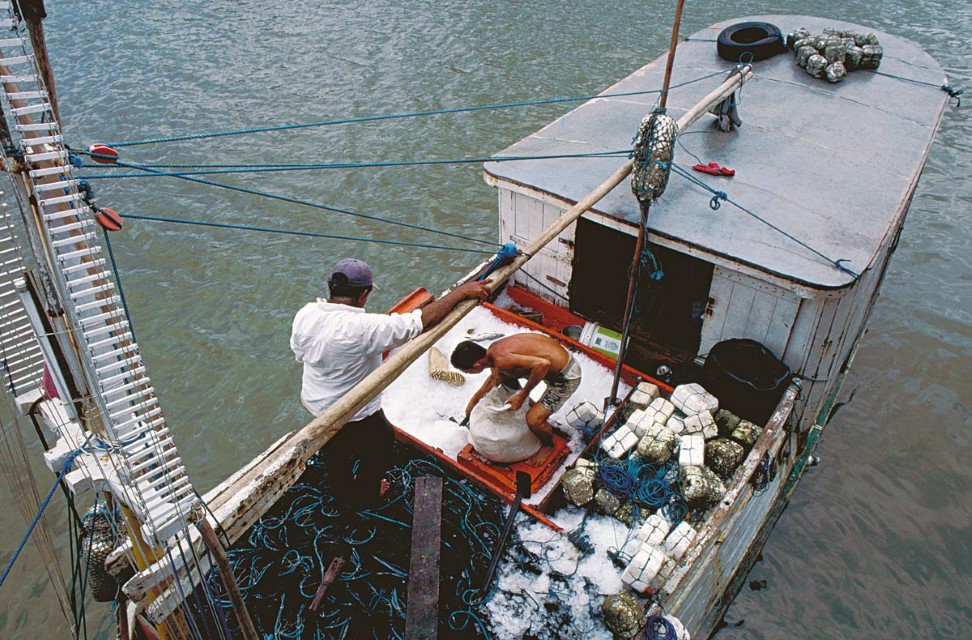
Considering the several factors that can distinguish types of fishing boats, ice box capacity is the most important because it largely determines how much fish can be transported. Fishing boats with large iceboxes can travel longer distances and remain fishing for longer periods. Approximately 95% of the fishing boats servicing Belém have icebox capacities larger than 1 ton and most estuary fishing boats have a 1-4-ton ice capacity. The largest boats can store up to 45 tons of ice. A common practice is for small boats to offload their fish to larger capacity boats. Fishing boat convoys are common along the Amapá coast. Large boats transport catches to markets while smaller vessels remain fishing for as long as three months.
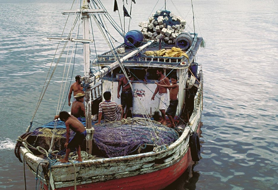
The most common fishing gear used in the coastal fisheries is the drifting gill net. The exact depths fished are controlled by lines tied to floats that remain at the surface. Gill nets can be as long as 10 km and mesh sizes range from 14 to 20 cm. When smaller meshes are used gill net lengths are decreased. Gill nets can also be joined to form one giant net up to 20 km in length. Fishermen who use such long gill nets must be very experienced because of the danger presented by current and wind action. Generally nets are placed in the water when the tidal current is minimal and the wind is sufficient to propel boats so that the net can be extended. One end of the net is tied to the boat and the other to a large float with a flag to mark it. Gill net fishermen usually fish near the coast and no deeper than about 20 meters. In Marajó Bay it is not possible to use gill nets larger than 1 km because there are so many fishermen in this area competing for space and theft is also a common problem.
Freshwater and marine catfish and croakers are the most abundant fish groups along the coast. Freshwater species are captured mainly during the first half of the year, a period when the Amazon River discharges huge quantities of freshwater; in contrast marine species are captured mostly during the latter half of the year when salt water dominates. Important by-products of fisheries include dried swim bladders of the gurijuba catfish (Hexanematichthys parkeri) and pescada amarela (Cynoscion acoupa) and dried fins of the cartilaginous sharks and skates (Carcharhinus spp. and Pristis spp.). These products command relatively high prices because of their export markets. Swim bladders are exported to international markets for use in specialized filters for clarifying wine or beer. Cartilaginous fins, destined to international markets for use in soups, are sometimes of more value than the flesh of the individual fish.
The trotline, a line with a series of hooks on shorter lines, is the most important type of hook-fishing in the estuary. In the past it was the principal gear used, but gill nets have now far surpassed trotlines in importance. Trotlines are usually employed in rocky areas or in straits between islands. The trotline is anchored to the bottom on either end by two rocks. Amuré gobies (Gobioides spp. Gobiidae), very common fishes in the estuary, serve as the most important bait. A typical trotline is 60 meters long with 40 hooks. A fishing boat may carry many trotlines that together can have more than 2,000 hooks.
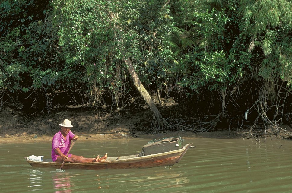
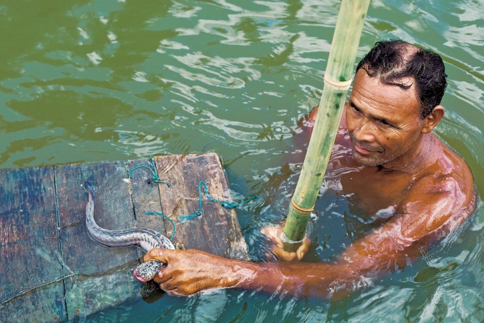
Bait fishermen represent a specialized traditional fishery called the amuré fishery that sustains trotline fishing. Amuré fishermen are called amurezeiros or mergulhões (divers). They fish from a small canoe between tidal cycles when waters are calm. Gear consists of a cast net, a 7-meter stick and a wooden box. Gobies are common in the muddy bottom, where they live in holes. Water depths are usually less than 6 meters. Fishermen cover goby holes with cast nets and then dive and step on the net, usually aided by holding onto the stick that has been sunken into the bottom. When gobies try to escape from the net they are captured by hand and placed alive in the floating wooden box. Goby fishermen can work only a few hours; when tides begin to increase they must desist.
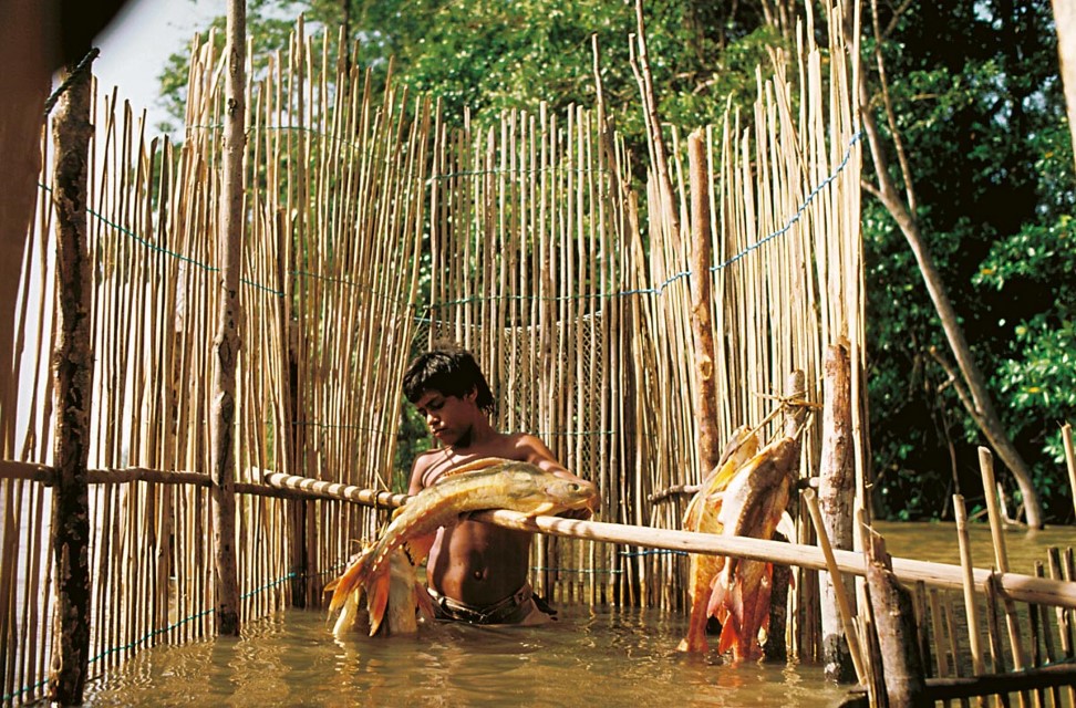
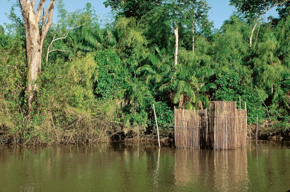
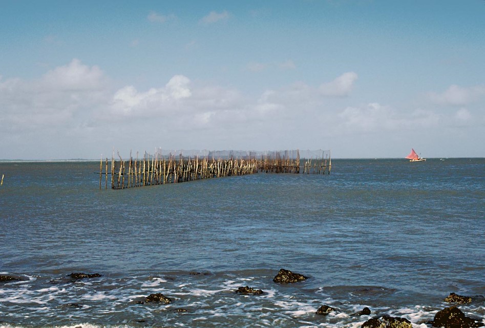
The curral (corral) is a weir commonly used in the tidal zone. The traditional curral is constructed from palm fibers and lianas. These weirs are placed perpendicular to shorelines in the intertidal zone. Water depth is usually no greater than 5 meters at high tide. Curral weirs can be up to 50 meters long and are made up of three principal parts. High walls corral the fish into the first chamber, where they remain during high tides; as water level falls the fish move into the lower, usually circular, chamber from which they can be removed during low tides.
Small fixed gill nets are used mostly over rocky bottoms, especially during quarter-moon phases when tides are relatively weak. Small gill nets are also used to block small tidal steams where fish can be captured when they leave with the onset of low tides. Weirs and fixed gill nets are used mostly close to the houses of fishermen and catches usually consist of pescada (Plagioscion squamosissimus), pescada gó (Macrodon ancylodon) and less valuable commercial species, such as bacu-pedra (Lithodoras dorsalis).
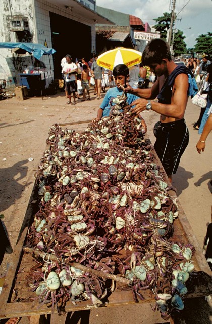
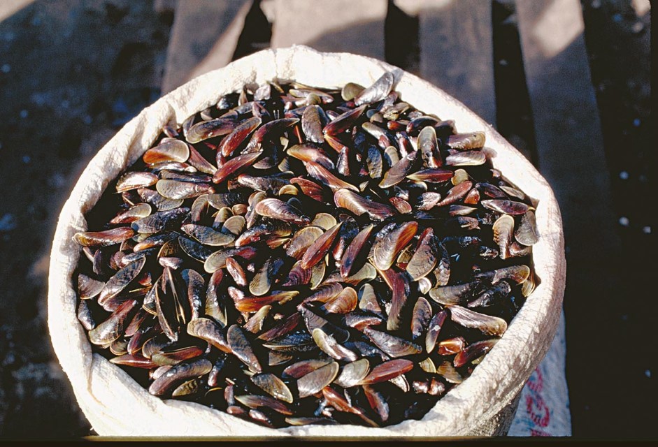
The Amazon coast supports one of the largest mangrove forests in the world. Most of this forest, however, is along the coast and not in the freshwater-dominated Amazon River and Marajó Bay areas. The largest mangroves are from near the Amazon River mouth to French Guiana. There are also considerable mangroves from northern Marajó Bay to the Parnaíba River. Mangrove fisheries are usually located where there is access from cities or roads. Mangrove fisheries are based largely on crabs and mollusks that are captured during low tides. The most important crab species captured is Ucides cordatus. The unusual, serpentine-shaped turu (Neoteredo reynei) is the most important mangrove mollusk (gastropod) captured. Mangrove bivalves include various species of the genus Mytella.
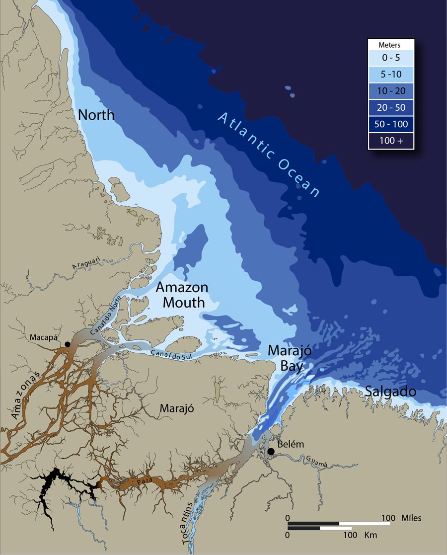
Because of the huge sediment load of the Rio Amazonas the estuary is relatively shallow, especially in the mouth and northern areas. Most commercial fishing for freshwater species takes place in depths less than 50 meters.
-
Estuario y la Costa Amazónica 0
Inside a fishing weir at edge of tidal forest near Vigía, Pará, Brazil. The fish is bacu pedra (Lithodoras dorsalis, Doradidae), a species which enters tidal forests to feed on fruits. Photographer: Michael Goulding
-
Estuario y la Costa Amazónica 1
Trawl catch of dourada (Brachyplatystoma rousseauxii) in Amazon estuary. Photographer: Michael Goulding
-
Estuario y la Costa Amazónica 2
Three trawl boats fishing together in fresh water abutting the Atlantic off of Marajó Island. Department – Country: Pará – Brazil Main Basin – Sub Basin: Amazon Main Stem – Eastern Amazon Main Stem Photographer: Michael Goulding
-
Estuario y la Costa Amazónica 3
Fishing weir and tidal forest near Vigía, Pará, Brazil. Photographer: Michael Goulding
-
Estuario y la Costa Amazónica 4
Boat of large-scale commercial fishing fleet of Amazon estuary. This type of boat can fish along the coastal areas of the estuary. Drifting gill nets can be more than 10,000 meters in length. Photographer: Michael Goulding
-
Estuario y la Costa Amazónica 5
Shrimp boat of Belém industrial fleet. This type of boat fishes along the Atlantic coast near the estuary. Department – Country: Pará – Brazil Main Basin – Sub Basin: Estuary – South Amazon Estuary Photographer: Michael Goulding
-
Estuario y la Costa Amazónica 6
Goby fishermen in Amazon estuary near Vigia. The box in the bow is placed in the water to house live gobies. Department – Country: Pará – Brazil Main Basin – Sub Basin: Estuary – South Amazon Estuary Photographer: Michael Goulding
-
Estuario y la Costa Amazónica 7
Gobies (Gobiodes) are captured by diving and extracting the fish from holes in the muddy bottom with the hands. Department – Country: Pará – Brazil Main Basin – Sub Basin: Estuary – South Amazon Estuary Photographer: Michael Goulding
-
Estuario y la Costa Amazónica 8
Crab (Ucides cordatus) from estuary mangrove. Photographer: Michael Goulding
-
Estuario y la Costa Amazónica 9
Sururu (Mytella spp., Mytilidae) bivalves for sale in Bragança, Pará. Photographer: Michael Goulding
-
Estuario y la Costa Amazónica 10
Loading ice onto fishing boat in Vigía, Amazon estuary. Photographer: Michael Goulding
-
Estuario y la Costa Amazónica 11
Atlantic Ocean near Algodoal Island in the southeast Amazon estuary. This zone is largely salt water but becomes brackish during the rainy season when local rivers discharge large quantities of freshwater. The structure in mid-photograph is a fish weir. Photographer: Michael Goulding
CONTEXT
The Andes
Cataratas
Floodplain or Várzea
River Mouth Bays
River Channel
Estuary & Amazon Coast
Marajó and Inner Delta
