

Coastal wetlands are also referred to as tidal wetlands, due to the significant influence that marine tides can have on water levels and the chemical composition of the water, depending on whether freshwater or brackish water predominates. The Amazon’s major coastal wetlands of the Estuary include open waters, forests, intertidal mud flats, and marshes.
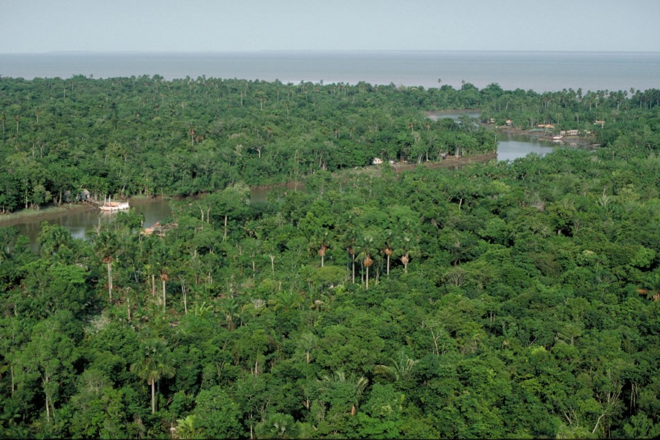
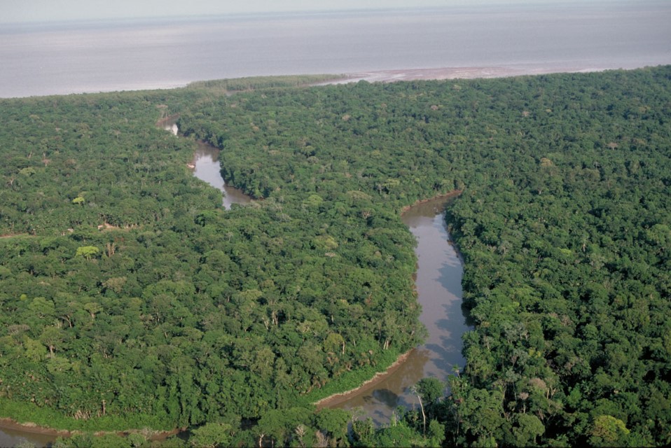
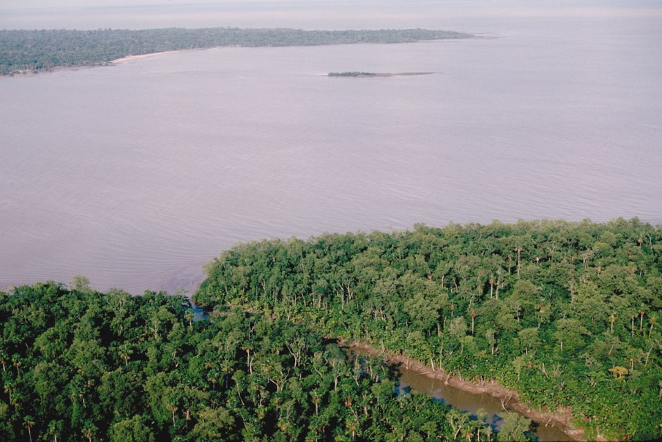
The Amazon estuary and coastal region, where freshwater or brackish water dominates, has large expanses of wetland forests. Because most of the region is freshwater, most tidal flooded forests there have largely the same tree species as those found upstream in seasonally flooded forests. Where waters are brackish during part of the year, mangroves dominate. There is also a relatively small transition zone where mangrove and freshwater flooded forest often coexist. Regardless of the type of vegetation, these forests are inundated twice daily by the tides. Spring tides occur twice monthly around new and full moon and result in greater flooding of the Estuary islands.
Large parts of the giant Marajó Island, especially its western half, are also inundated by the tides. Palm-dominated tidal forests occur inland, out of the reach of brackish water, and are common for example on the islands near Belém and along the lower Tocantins River, as well as in some of the archipelagos surrounding Marajó Island. Mangrove forests are most abundant along the Amapá coast and the wide mouth of Marajó Bay toward the Maranhão coast.
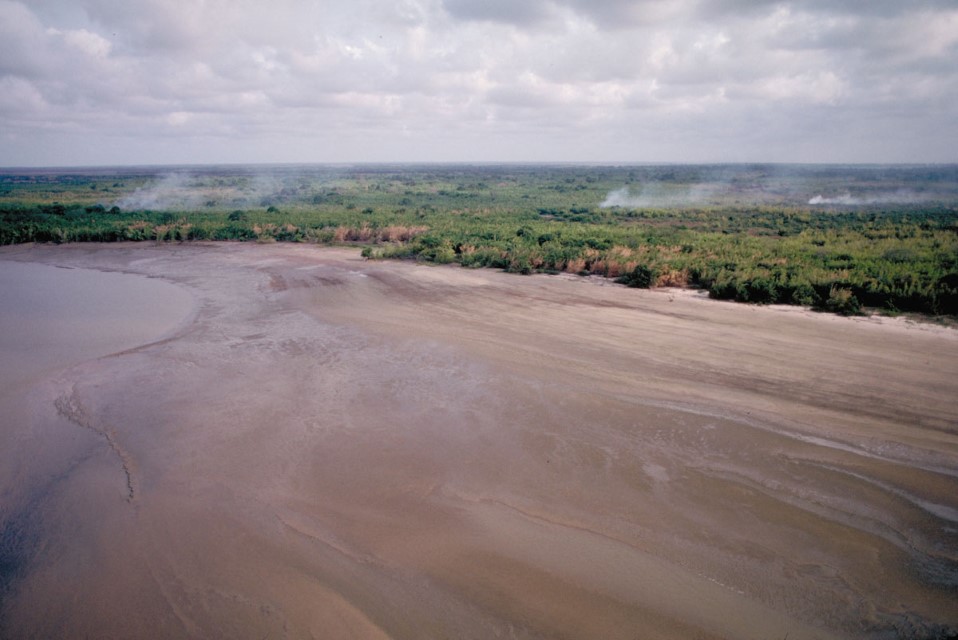
Tidal mud flats are important habitats thanks to the huge sediment load the Amazon River deposits in the Estuary, as well as the effects of brackish water brought by the Atlantic Ocean. Many are colonized by plants like the giant aroids of the genus Montrichardia, but mud flats also provide habitat for many aquatic and semi-aquatic animals, including numerous wading birds such as the spectacular scarlet ibis.
Although most of the shores in the Amazon estuary are covered by mud, there are also sandy beaches, especially in the Marajó Bay area. The clearwater Tocantins River discharges into the Pará River, which then enters the Bay, and fine sand is transported along this route and deposited on beaches not covered by mud.
There are also alluvial flats in this region with relatively thick clay deposits, which are mined for bricks and pottery. Sandy dunes are also found along the northern coast of Marajó Island, and their origin appears to be sand carried northeast by the Atlantic South Equatorial Current from the area just outside Marajó Bay. Rocky shores of any extent within the estuary are only found along Marajó Bay, especially along Marajó Island. The rock is locally called canga, and is derived from laterite, soils rich in iron and aluminum.
-
Humedales de mareas 01
Freshwater tidal forest of the Amazon Estuary heavily dominated by palms. Department – Country: Pará – Brazil Main Basin – Sub Basin: Estuary – South Amazon Estuary Elevation: 10 Photographer: Michael Goulding
-
Humedales de mareas 01b
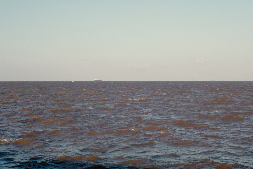
Amazon River at its mouth. Department – Country: Amapá – Brazil Main Basin – Sub Basin: North Amazon Estuary – North Amazon Estuary
-
Humedales de mareas 02
Extensive sediment deposits near the mouth of the Amazon River form large mudflats that are abutted by freshwater tidal forest. Department – Country: Pará – Brazil Main Basin – Sub Basin: Estuary – South Amazon Estuary Elevation: 3 Photographer: Michael Goulding
-
Humedales de mareas 03
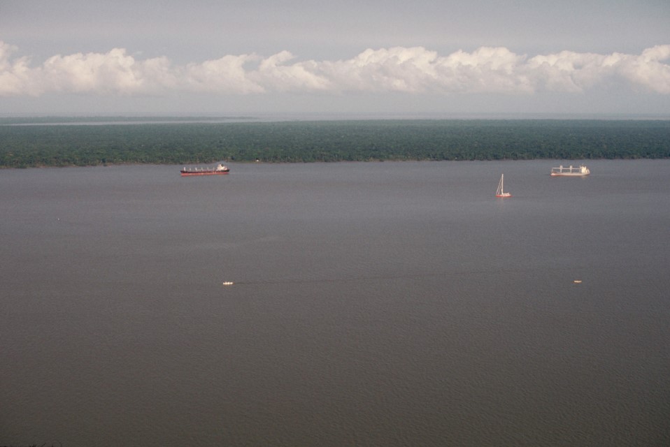
Amazon estuary near Belem with tidal forest in the background. Department – Country: Pará – Brazil Main Basin – Sub Basin: Amazon Main Stem – Eastern Amazon Main Stem Photographer: Michael Goulding
-
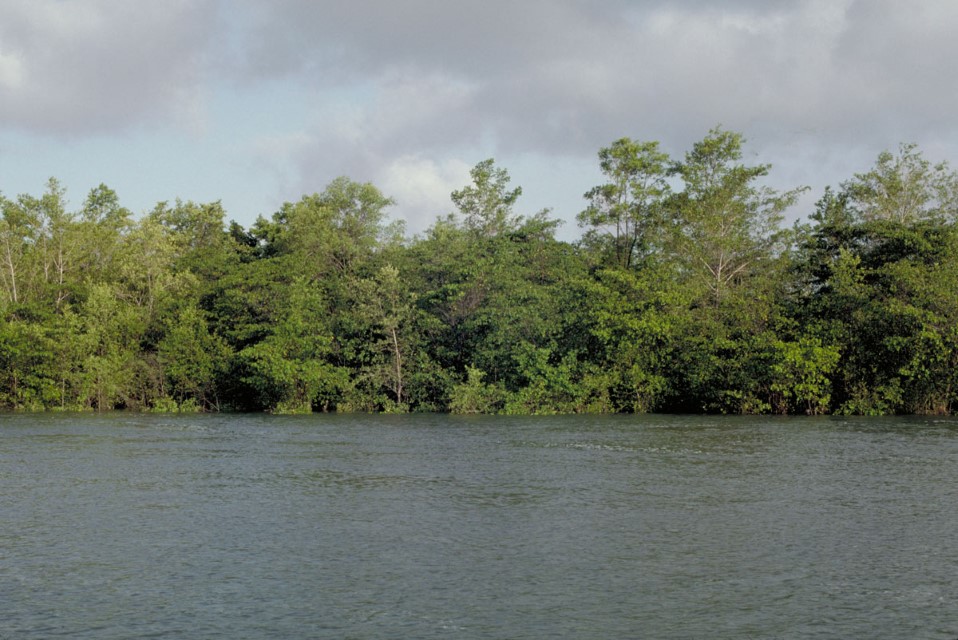
Humedales de mareas 04
Estuarine tidal forest consisted of both mangrove and freshwater species along Marajo Bay. Department – Country: Pará – Brazil Main Basin – Sub Basin: Estuary – South Amazon Estuary Elevation: 19 Photographer: Michael Goulding
-
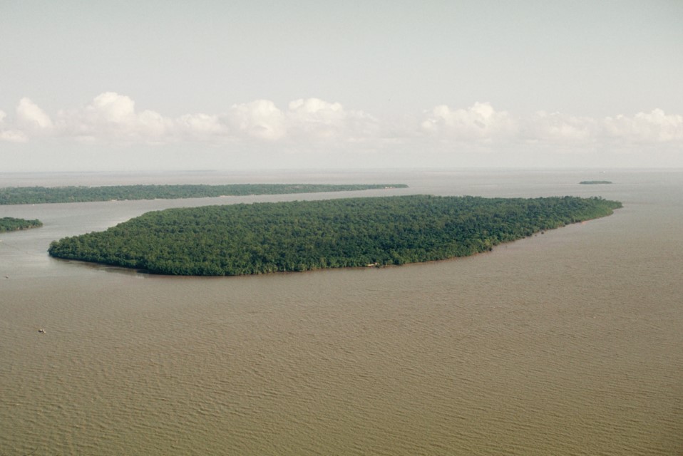
Humedales de mareas 05
Tidal forest island of the Amazon estuary near Belem. Department – Country: Pará – Brazil Main Basin – Sub Basin: Estuary – South Amazon Estuary Photographer: Michael Goulding
-
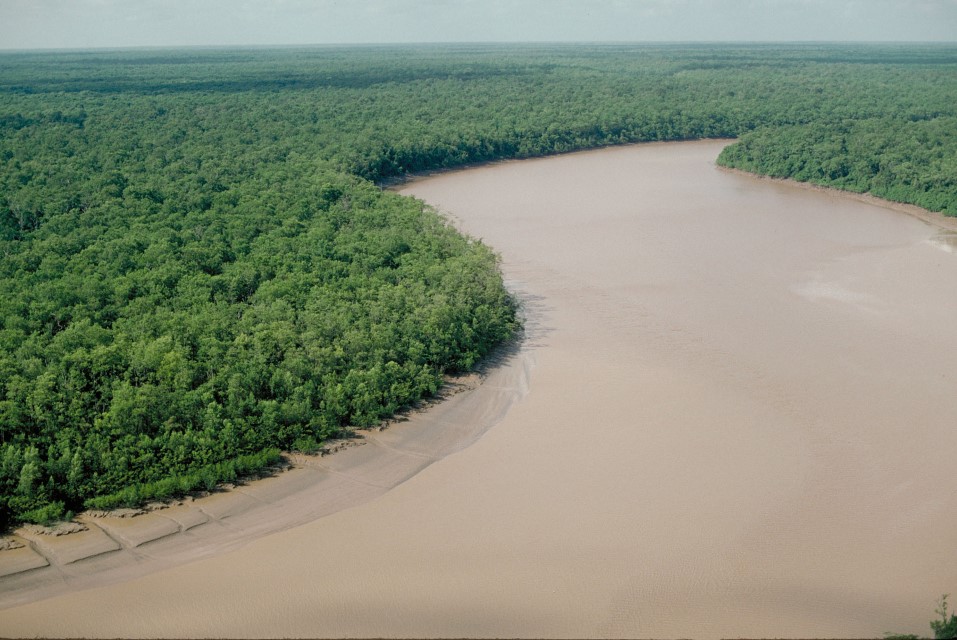
Humedales de mareas 06
Mangrove along the Amapá coast just north of the Amazon River mouth that indicates a mixture of fresh and salt water. Department – Country: Amapá – Brazil Main Basin – Sub Basin: North Coast Basins – Araguari Elevation: 14 Photographer: Michael Goulding
-
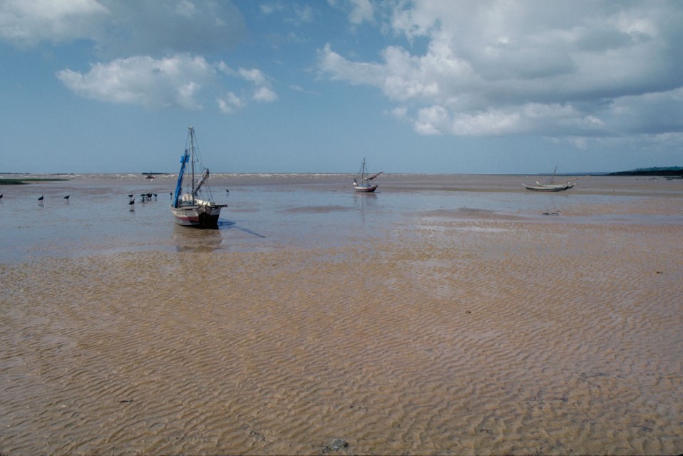
Humedales de mareas 07
The estuary near where Marajó Bay meets the Atlantic. During the Amazon River’s high water period freshwater extends out of Marajó Bay and along the Atlantic coast. Department – Country: Pará – Brazil Main Basin – Sub Basin: Estuary – South Amazon Estuary Elevation: 19 Photographer: Michael Goulding
-
Humedales de mareas 08
Tidal forest of islands of the Pará River. Department – Country: Pará – Brazil Main Basin – Sub Basin: Estuary – South Amazon Estuary Elevation: 10 Photographer: Michael Goulding
-
Humedales de mareas 09
Tidal forest along islands of the Pará River. Department – Country: Pará – Brazil Main Basin – Sub Basin: Estuary – South Amazon Estuary Elevation: 10 Photographer: Michael Goulding