

Flooded forests, key to aquatic biodiversity
Flooded forests are also wetlands, and the Amazon Basin has the most species-rich flooded forests in the world. They are most extensive on the large floodplains, including those of the estuary under tidal control.
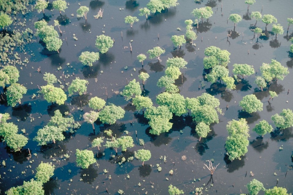
Negro River flooded forest. Department – Country: Amazonas – Brazil Main Basin – Sub Basin: Negro – Lower Negro Main Stem Elevation: 30 Photographer: Michael Goulding
Flooded forests formed on the floodplain are not uniform and species diversity can vary not only between water types but also along flooding gradients. Flooding periods when Amazonian floodplain forests remain covered by water vary across the basin. For example, near Manaus in the Central Amazon, ranging from 140 days for tree communities at higher elevations to 230–270 days for forests of the lower floodplain. Flooding depths can vary from 7 m for low shrub forest to 2.5 m for high levee forest. Most of the floodplain forest is inundated to depths of 2.5–5.0 m during most of the flood season.
Among low elevation whitewater flooded forests, floristic composition is highly similar across large areas of the Amazon Basin. Species richness is correlated with flood depth, average annual flooding time, and forest age. The maximum species richness recorded per hectare in whitewater floodplains reaches about 60–70% of that found in nearby upland forests. Blackwater flooded forests have many species not found in their whitewater counterparts, while clearwater flooded forests often combine species from both, showing intermediate species richness.
Amazonian wetland forests can be classified by a combination of their water type and flooding regimes:
- Seasonally flooded forests are inundated by a fairly predictable annual cycle. In most of the Amazon Basin there is one flooding period that lasts 3-7 months depending on the exact location. Near the equator there can be bimodal flooding, though one flooding period is relatively short and lasts no more than a few weeks. The largest seasonally inundated wetland forests are found in whitewater and blackwater river floodplains, also known as várzeas and igarapós, respectively.
- Tidal forests Mangroves are found in the Amazon Estuary and are inundated twice daily. As in all tidal systems, flooding is most extensive during full moon and new moon tides that occur twice monthly. The huge discharge of the Amazon River, along with that of the Tocantins River to its south, guarantees that most of the estuary contains freshwater during the entire year. Estuarine wetland forests are very similar in species composition to their upstream seasonally flooded forests, though poorer in total species. Close to the Atlantic where brackish water dominates for at least a few months of the year mangrove trees predominate and border most of the eastern coast of the state of Amapá north of the Amazon River mouth.
- Irregularly flooded forest occur mostly along small streams whose flooding is controlled mainly by local rainfall. Streams in lower areas, however, can be dammed back by the main rivers, generating characteristics like those of the seasonal flooded forests or dominated by palm swamps, depending on the exact local conditions.
- Long-term flooded shrub communities are found in low floodplain areas where inundation can be longer than 6 months. These plant communities are dominated by shrubs with special adaptations for survival in these habitats that trees apparently lack. In the Brazilian Amazon, they are often called locally chavascal or xavascal. They are relatively low in species diversity.
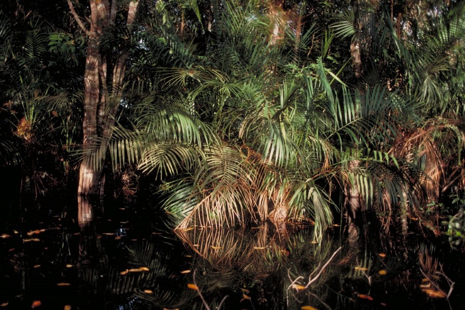
- Palm swamps are found on floodplains, in upland depressions areas and in savannas inundated mostly with rainwater. Depending on their location, many of these wetlands could be lumped with seasonally flooded forest, tidal forest or mangroves, or savanna forest. It is useful, however, to consider them specifically because, unlike other flooded forests, they are dominated by one or, less commonly, two to three palm species. Palm species of the genus Mauritia are by far the most widespread found in these wetlands and are highly adapted to waterlogged soils under almost all conditions. These wetlands are widely known as aguajales or morichales in Spanish-speaking countries and buritizais or miritizais in Brazil. The açaí palms, whose fruits are used in juices, smoothies, and desserts, are another example of a palmp species often found in this type of wetland, such as in the estuary.
-
Bosques de humedales 1
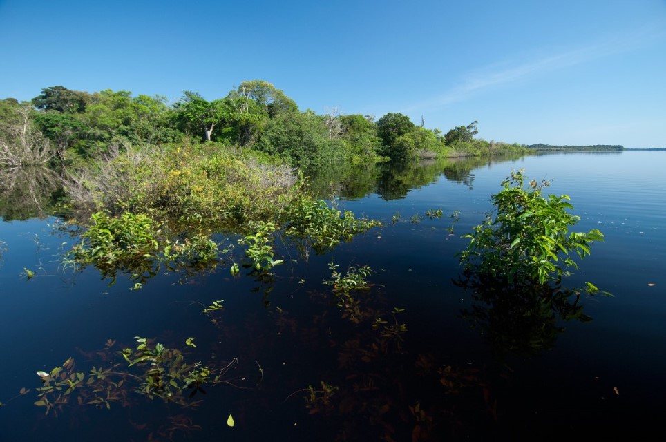
Negro River channel along the Anavilhanas Archipelago during the flooding season when shrubs and trees become inundated for 4-7 months. Department – Country: Amazonas – Brazil Main Basin – Sub Basin: Negro – Lower Negro Main Stem Photographer: Luiz Claudio Marigo
-
Bosques de humedales 3
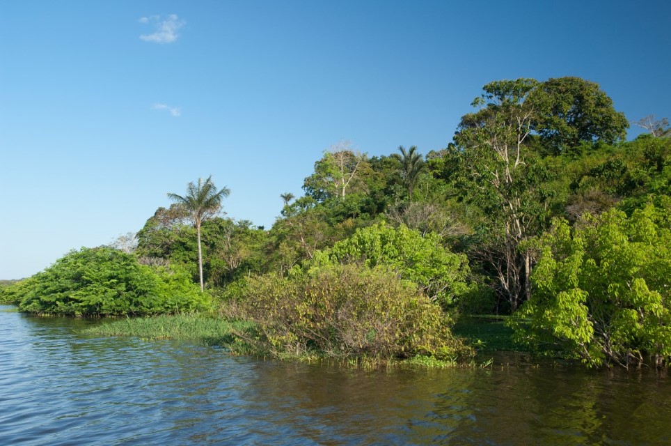
Flooded forest at edge of river channel. Department – Country: Amazonas – Brazil Main Basin – Sub Basin: Negro – Lower Negro Main Stem Photographer: Luiz Claudio Marigo
-
Bosques de humedales 4
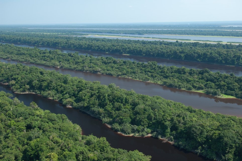
The Anavilhanas Archipelago of the lower Negro River consists entirely of wetland forest. Department – Country: Amazonas – Brazil Main Basin – Sub Basin: Negro – Lower Negro Main Stem Photographer: Luiz Claudio Marigo
-
Bosques de humedales 5
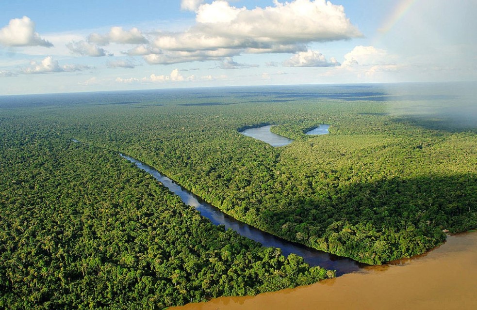
Vast aguaje palm swamps abutting the Marañón River and a small blackwater tributary. Department – Country: Loreto – Perú Main Basin – Sub Basin: Amazon Main Stem Minor Basins – Nanay Photographer: Walter Wust
-
Bosques de humedales 6
The Amazon Basin has extensive palm swamps. Many palm species are highly adapted to within flooding or waterlogged soils during most of the year. Shown here is Leopoldinia pulchra. Department – Country: Pará – Brazil Main Basin – Sub Basin: Amazon Main Stem – Eastern Amazon Main Stem Elevation: 32 Photographer: Michael Goulding
-
Bosques de humedales 7
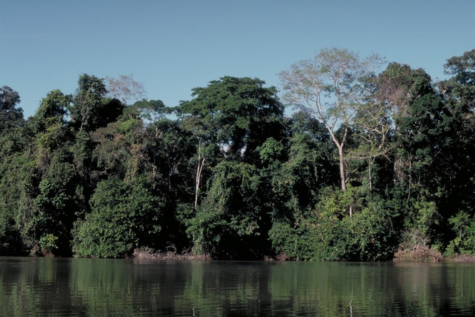
Tall wetland forest in Manú National Park. Department – Country: Madre de Dios – Perú Main Basin – Sub Basin: Madeira – Madre de Dios Elevation: 353 Photographer: Michael Goulding
-
Bosques de humedales 8
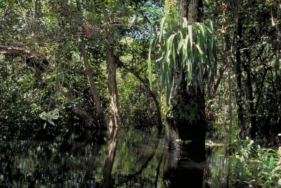
Inside flooded forest at the height of the annual flood near the confluence of the Amazon and Tapajós rivers. Department – Country: Pará – Brazil Main Basin – Sub Basin: Amazon Main Stem – Eastern Amazon Main Stem Elevation: 32 Photographer: Michael Goulding
-
Bosques de humedales 9
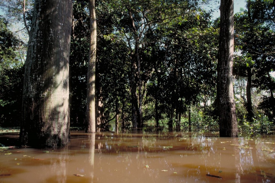
Amazon River water invading wetland forest and also depositing nutrient-rich sediments. Department – Country: Pará – Brazil Main Basin – Sub Basin: Amazon Main Stem – Eastern Amazon Main Stem Elevation: 32 Photographer: Michael Goulding
-
Bosques de humedales 10
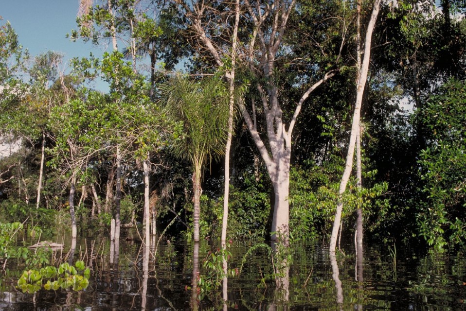
Flooded forest of the middle Negro River. Note that there are several distinct forest layers, though the lower layers are almost or completely submerged. Department – Country: Pará – Brazil Main Basin – Sub Basin: Amazon Main Stem – Eastern Amazon Main Stem Elevation: 32 Photographer: Michael Goulding
-
Bosques de humedales 11
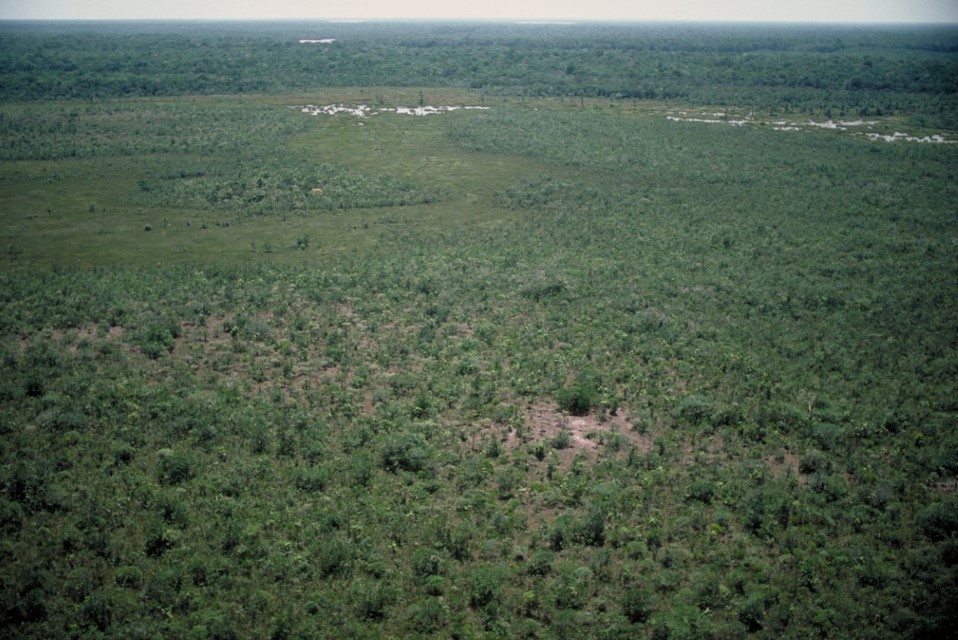
The Negro Basin has extensive shurb communities, known locally as campinas, growing on highly sandy soils that become inundated by rain and river water. Shown here is a campina during the dry season. Department – Country: Amazonas – Brazil Main Basin – Sub Basin: Negro – Negro Main Stem Elevation: 34 Photographer: Michael Goulding
-
Bosques de humedales 12
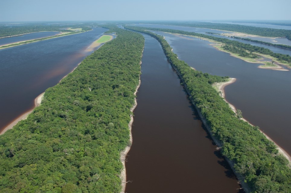
Floodable forest of the lower Negro River during the low water season when the forest floor is dry. Department – Country: Amazonas – Brazil Main Basin – Sub Basin: Negro – Lower Negro Main Stem Photographer: Luiz Claudio Marigo
-
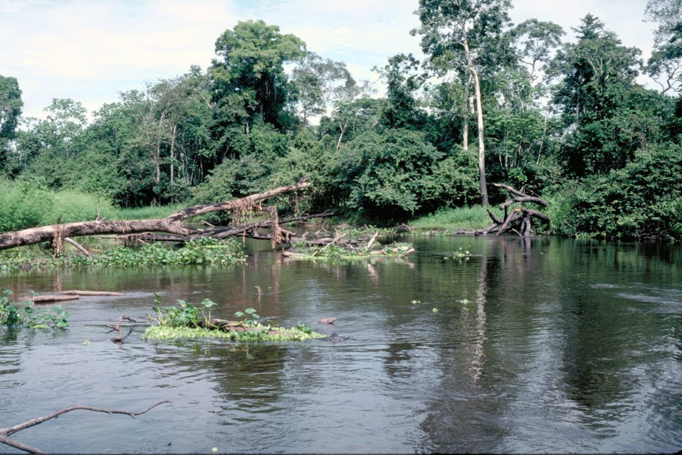
Bosques de humedales 12b
River channel and wetland forest in the Pacaya-Samiria National Reserve. Department – Country: Loreto – Perú Main Basin – Sub Basin: Marañón – Marañón Main Stem Elevation: 112 Photographer: Michael Goulding
-
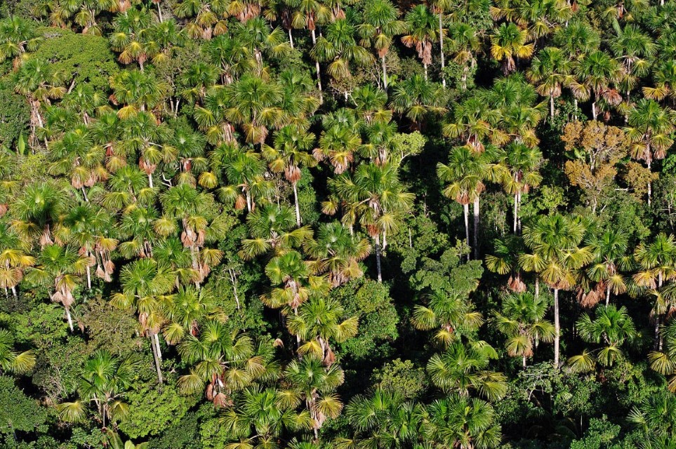
Bosques de humedales 13
Aguaje Palm Swamp (Mauritia flexuosa) Department – Country: Loreto – Perú Main Basin – Sub Basin: Marañón – Canal Principal del Marañón Elevation: 112 Photographer: Michael Goulding