
Rivers and Streams Are Wetlands
Rivers and streams are also wetlands. The Ramsar Convention on Wetlands considers them within the same wetland category, an ecologically useful decision as they represent a continuous hydrological system. Although the words “stream” and “river” can cause confusion to the public because the difference between the terms is not always clear, both terms refer to water bodies flowing across the terrestrial surface, the former with narrower, shallower channels, whereas the latter are considerably larger. Aquatic animals use both rivers and streams and migrate seasonally between various wetland types, such as streams, lakes and floodplain forests.
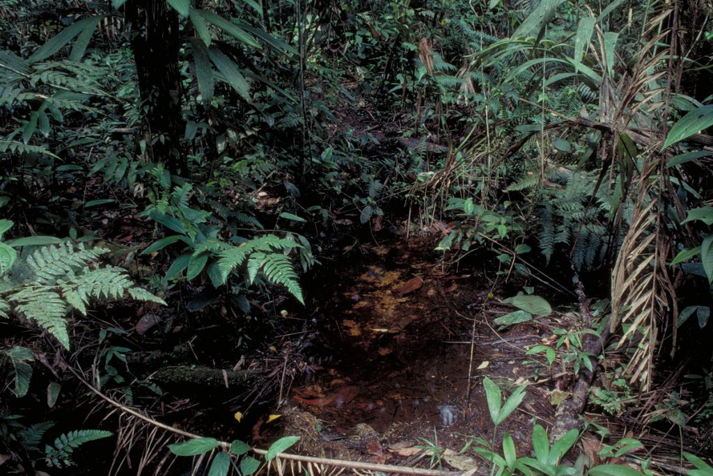
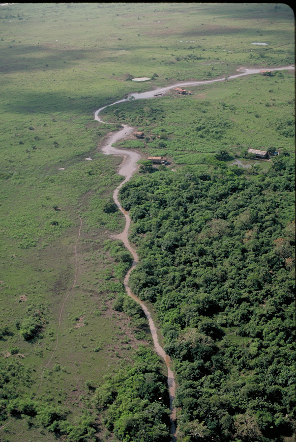
Depending on whether they have permanent or seasonal water flow, rivers and streams can be categorized into distinct wetland sub-types. Many streams in both the rainforest and drier areas of the Amazon Basin have intermittent flow, either caused by changes in precipitation or discharge levels from springs or a combination of both. In the arid areas of the Andes above about 3,000 m many riverbeds can become completely dry or nearly so during the dry-season months. Large-scale deforestation in areas such as the southern Amazon Basin of Brazil also leads to desiccation of small streams that would otherwise maintain at least some flow under forest shade even during dry periods.
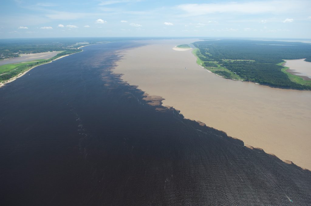
Rivers and streams can also be classified according to the chemical composition of their waters, using the transparency and color of the water as indicators for this division. Whitewater rivers and streams arise in the Andes where high precipitation and erosion render their waters turbid and nutrient rich. Rivers and streams that transport minimal sediment loads can be divided into clearwater and blackwater types, though in some areas there are transitions between the two that can make their classification more complex. Clearwater streams and rivers are found throughout the Amazon Basin under natural conditions.
In the Andes most rivers and streams above about 1,000 m run relatively clear during at least during a few months of the year when rainfall is insufficient to cause major erosion in their drainage. Most streams in the lowland rainforest have relatively clear waters. The largest clearwater rivers in the Amazon Basin drain the Brazilian and Guiana Shields, which are ancient and highly eroded areas north and south of the eastern Amazon Basin. Blackwater streams and rivers can arise in the Andes, on the Brazilian and Guiana shields, and in the lowlands. They are relatively rare in the Andes but do occur in areas draining peatlands or highly sandy soil basins. The largest extent of blackwater rivers and streams in the Amazon Basin can be found in sandy soil basins of the lowlands with headwaters on the Brazilian and Guiana Shields, with the Negro River being the most extensive.
We recommend you read the sections on water types: white water, clear water, and black water.
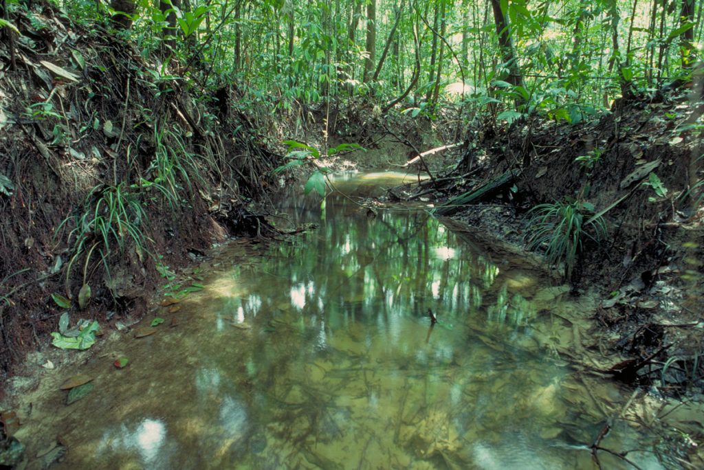
Rainforest stream in the Central Amazon with riparian forest that becomes flooded with heavy local rains. Department – Country: Brazil – Amazonas Main Basin – Sub Basin: Negro – Lower Negro Main Stem Photographer: Michael Goulding
A special type of wetland formed by rivers occurs in the central and eastern Amazon, where the lower parts of many rivers have the appearance of lake-like water bodies formations known as rias or drowned mouth-lakes. The mouth-lakes are formed in geologic faults that were excavated by fluvial processes when sea levels were lower during the Ice Ages and river currents were swifter.
Cataracts and waterfalls might also be classified as wetland sub-types of rivers. Small waterfalls are common in the humid areas of the eastern slopes of the Andes, and some plunge spectacularly for several hundred meters. The Brazilian and Guiana Shield rivers have numerous cataracts and waterfalls. Perhaps the most spectacular rapids were those of the Madeira River in Rondônia, but they are now completely inundated by the two large dams built there in the last decade.
-
Ríos y arroyos 1
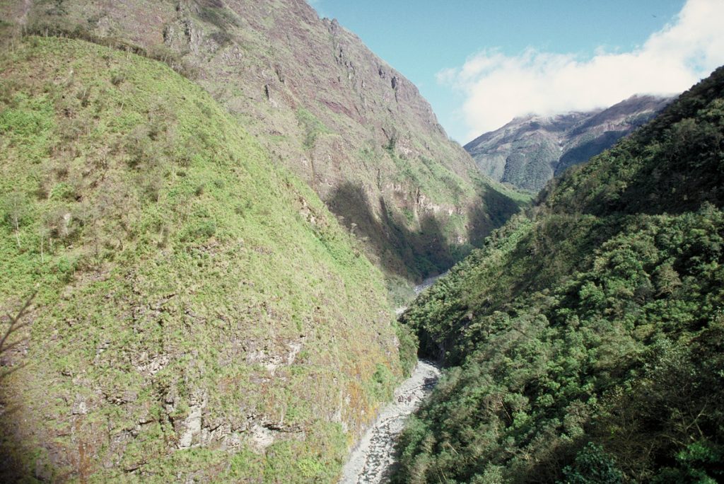
At higher and drier elevations in the Andes stream flow can be minimal and in many cases non existent during the driest months. Department – Country: La Paz – Bolivia Main Basin – Sub Basin: Madeira – Beni Elevation: 4737 Photographer: Michael Goulding
-
Ríos y arroyos 2
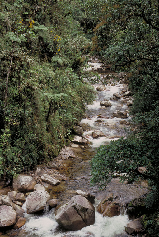
Stream originating in and flowing through cloudforest. These streams usually have clear waters except when there are heavy local rains. Department – Country: Madre de Dios – Peru Main Basin – Sub Basin: Madeira – Madre de Dios Elevation: 2,400 Photographer: Michael Goulding
-
Ríos y arroyos 5
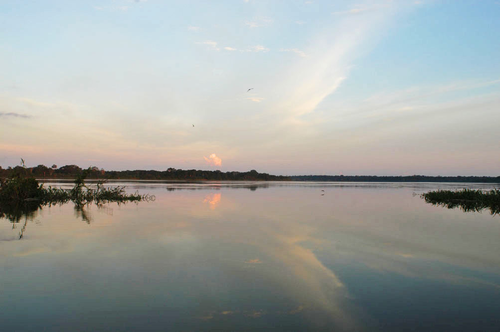
Side channel of the Ucayali River. Department – Country: Loreto – Perú Main Basin – Sub Basin: Ucayali – Ucayali Main Stem Photographer: Walter Wust
-
Ríos y arroyos 6
The meeting of the Amazon and Negro rivers shows the great contrast in river types in the lowlands. Department – Country: Amazonas – Brazil Main Basin – Sub Basin: Amazon Main Stem – Eastern Amazon Main Stem Photographer: Luiz Claudio Marigo
-
Ríos y arroyos 7
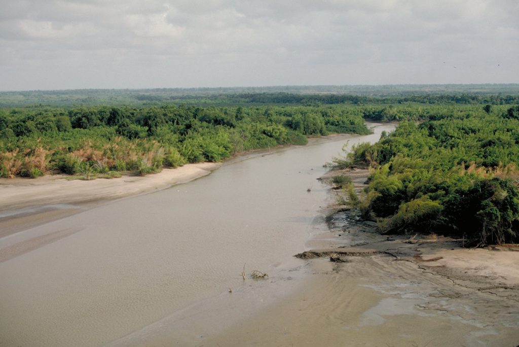
Estuarine small river with mangrove. Department – Country: Pará – Brazil Main Basin – Sub Basin: Estuary – South Amazon Estuary Elevation: 3 Photographer: Michael Goulding
-
Ríos y arroyos 8
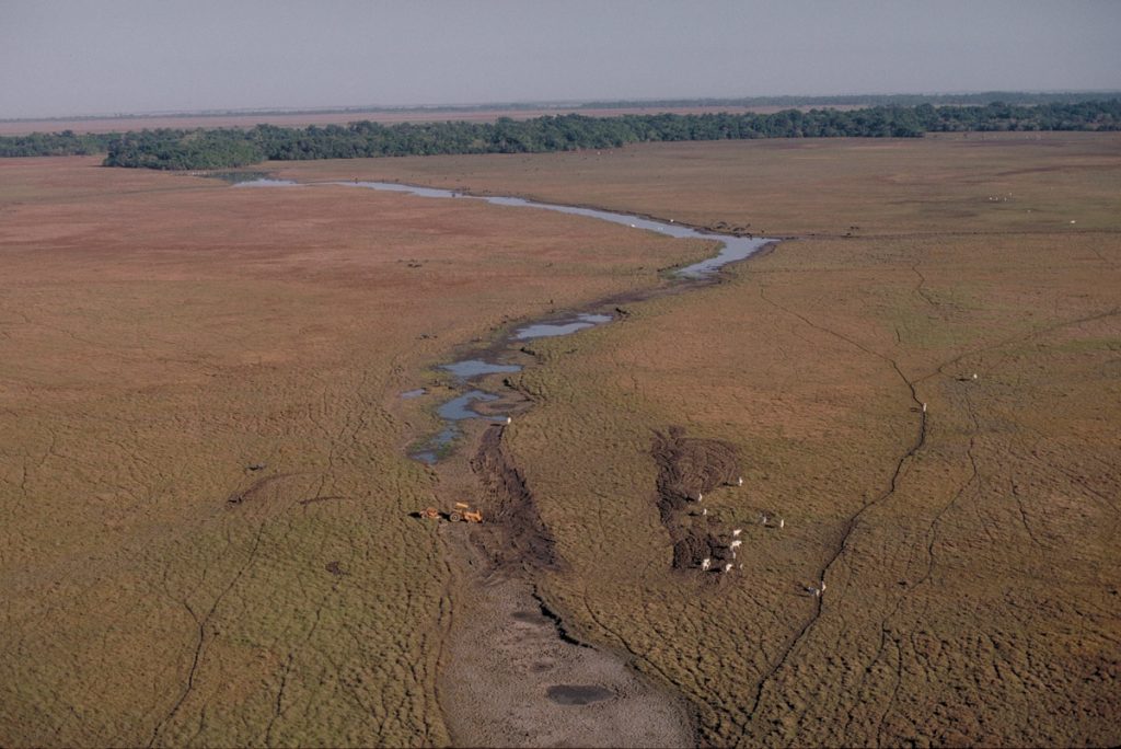
Deforestation and/or tree and shrub destruction by fire along riparian streams can lead to seasonal rather than permanent flow. Department – Country: Pará – Brazil Main Basin – Sub Basin: Estuary – South Amazon Estuary Elevation: 3 Photographer: Michael Goulding
-
Ríos y arroyos 10
Seasonal stream on Marajó Island that can become completely dried up during the dry season. Department – Country: Pará – Brazil Main Basin – Sub Basin: Estuary – South Amazon Estuary Elevation: 3 Photographer: Michael Goulding
-
Ríos y arroyos 11
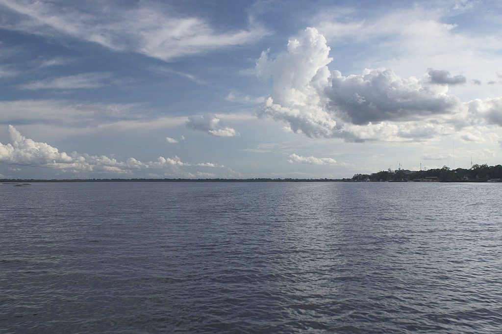
Amazon River (Amazonas) channel near Iquitos Peru. Department – Country: Loreto – Perú Main Basin – Sub Basin: Amazon Main Stem Minor Basins – Nanay Photographer: Walter Wust